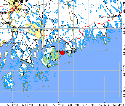
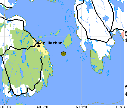
General Information | |
| Region: 3 km Southeast of Bar Harbor, Maine | |
| Date: 09/22/2006 | |
| Time (gmt): 10:39:21.4 | |
| Magnitude: Mn 3.4 (WES) | |
| Latitude: 44.35N | |
| Longitude: 68.19W | |
| Depth: 5 km | |
|
|
|
|
Seismograms recorded by LCSN Station NCB (Newcomb, NY) |
 |
Broadband, Vertical-component seismic record at NCB (Newcomb, NY; distance=488 km)
in Adirondack Mountains from the 3 October 2006 event. P wave from the quake should
arrives at around 00:08:51, but it is very weak.
Source Mechanism and Focal Deth
 |
Focal mechanism of the October 3, 2006, Bar Harbor, Maine earthquake determined by
using seismic signals recorded at regional distances (from 70 km to 598 km).
Waveform data are used to determine focal depth and source mechanism
parameters using moment tensor inversion method.
This is a preliminary results. Source mechanism indicates predominantly thrust
faulting along moderately dipping fault planes striking due north or due south.
Source depth of 2 km fits the observed records best.
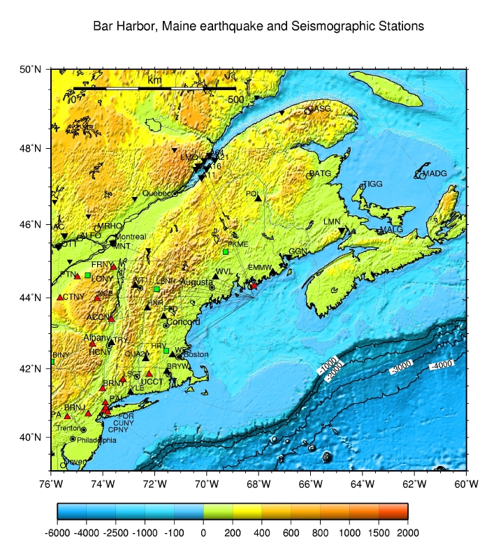
Data source: broadband stations of the regional seismographic networks
in the Northeastern United States and southeastern Canada.
Networks and stations used: NESN (EMMW, WVL, WES),
LCSN (ACCN, FRNY, NCB, HCNY, PTN, PAL)
USNSN (LBNH, LONY)
CNSN (GGN, LMQ, MNT, GAC)
GSN (HRV)
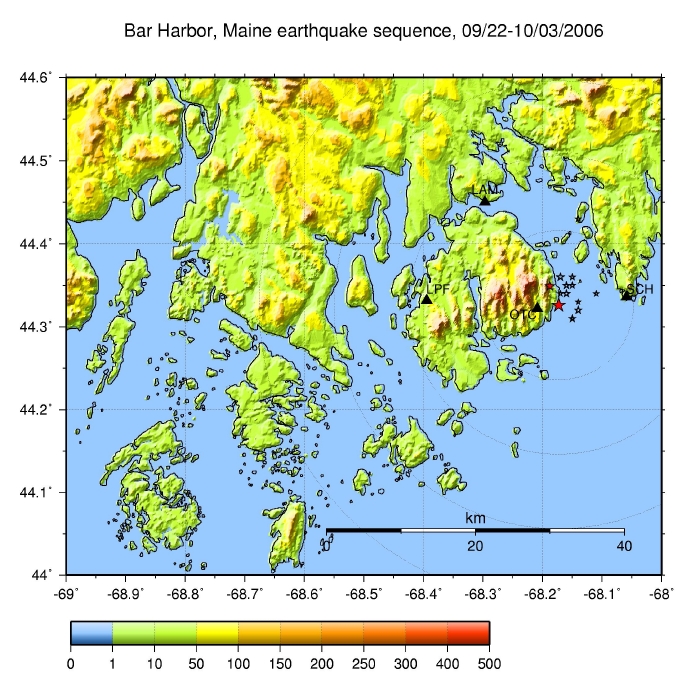 |
Recent Bar Harbor, Maine earthquake sequence has been fairly well
recorded by regional and national seismographic networks.
In order to detect and locate very small earthquakes that may
occur in the epicentral area, LCSN deployed portable
seismographic stations in the epicentral area.
Field crew from Lamont-Doherty deployed
four portable seismographic stations in and around Mount Desert Island
during Wednesday and Thursday (10/04-10/05) through timely help from
staff at the Maine Geological Survey, the Acadia National Park,
Weston Observatory of Boston College, and others in the area.
Four stations deployed are indicated by triangles on the map.
These stations are:
1) Otter Creek, Mount Desert Island, 4 km South of Bar Harbor
Mr. Kevin Le Clair's back yards, AC power/ CMG-40T broadband
seismometer
2) Long Pond Fire Road, Pretty Marsh, western Mount Desert Island,
Mr. Charles Jacobi of the park office lead us to the site,
solar panel - battery/ CMG-40T broadband seismometer,
3) Schoodic Point, east of the Mount Desert Island,
Mr. Edward Pontbriand of the park service helped us
to the site (old naval base), AC power with CMG-40T broadband
seismometer,
4) Lamoine State Park, north of the Mount Desert Island,
Mr. Jay MacIntosh of the state park service helped us
locating and installing a station at the shore front of the
park, solar panel - battery/ L-22 short-period seismometer.
Additional links