![]()
 |
 |
|---|
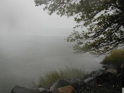
General Note: Snapshot Day Participants 2005 faced residual effects of Hurricane Tammy as they collected data. Weather conditions ranged from wet to wetter. Driving rains dumped inches of rain throughout the Hudson Estuary. Piermont area (image above) received 3.9 inches of rain during the day and Manhattan received 4.26 inches of rain, a record rainfall amount for one day according to the National Weather Service. Flood Watches were in place for much of the participating area. |
|---|
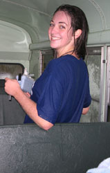
In some instances participants had shelters where they could huddle and perform test. In other areas they used school buses as a base of operations (Mahopac HS image). Still others ran quick tests in the driving rain and headed home. A few schools unfortunately had to cancel their involvement and are looking forward to next year. While the data collection was less comprehensive in some locations than in prior years due to the poor weather conditions, dedicated students, teachers and environmental educators did a remarkable job of gathering baseline information in all reaches of the estuary. The rainy conditions actually offer a unique set of factors which can be used in data examination:
These and other questions make this year's data interesting to consider. |
|---|
*Most files saved as word, and pdf documents; Sites/Participants is pdf; Chlorophyll and Sediment Samples are linked web pages.
| Master excel file (xlsx) | Files By Topic (pdf) | Site Names/Locations | Files by Site (word) | Files by Site (pdf) |
|---|---|---|---|---|
| Combined excel file | Sites & Participating Groups | Troy NY - Junior Museum/Heatly School | RM 151 | RM 151 |
Files By Topic (word) |
Files By Topic (pdf) |
Stuyvesant Landing - Columbia County Soil & Water | RM 127 | RM 127 |
| Dissolved Oxygen | Dissolved Oxygen | Nutten Hook, Stuyvesant - Columbia Land Conservancy | RM 124 | RM 124 |
| pH | pH | Coxsackie - DEC Five Rivers | RM 123 | RM 123 |
| Phosphates | Phosphates | Cohotate Preserve, Athens - Greene County Soil & Water | RM 115 | RM 115 |
| Nitrates | Nitrates | Saugerties Light House, Woodstock Day School | RM103 | RM 103 |
| Alkalinity | Alkalinity | Ulster Landing Park, Ulster - EMC | RM 97 | RM 97 |
| Salinity | Salinity | Esopus Meadows Environmental Center, Esopus - Clearwater | RM 87 | RM 87 |
| Physical Factors | Physical Factors | Norrie Point, Staatsburg - HRNERR | RM 85 | RM 85 |
| Tides | Tides | Waryas Park - Poughkeepsie, Mid-Hudson Children's Museum | RM 76 | RM 76 |
| Currents | Currents | Long Dock, Beacon | RM 61E | RM 61E |
| Shipping | Shipping | Newburgh Landing, Newburgh | RM 61W | RM 61W |
| Weather | Weather | Kowawese Park, New Windsor | RM 59 | RM 59 |
| Fish | Fish | Verplanck - Mahopac High School | RM 41 | RM 41 |
| CPUE (Fish Count Per Unit of Effort) | CPUE (Fish Count Per Unit of Effort) | Piermont Pier, Lamont-Doherty Earth Observatory | RM 25 | RM 25 |
| Chlorophyll | Hudson River Museum |
RM 19E | ||
| Sediment Samples | Alpine Boat Basin, Tenafly Nature Center | RM19W | RM 19W | |
| Beczak Environmental Center, Yonkers | RM 18 | RM 18 | ||
| Inwood Park, NY Park Rangers | RM 15 | RM 15 | ||
| Swindler's Cove, New York Restoration Project | RM 13 | RM 13 | ||
| 79th Street Boat Basin, Manhattan - Metro Montessori School | RM 6 | RM 6 | ||
| Christopher Street Pier - New York City Soil & Water | RM 4 | RM 4 | ||
| Manhattan - The River Project | RM 2 | RM 2 | ||
| Gowanus Canal - Urban Park Divers | RM0 | RM 0 |