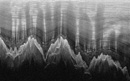


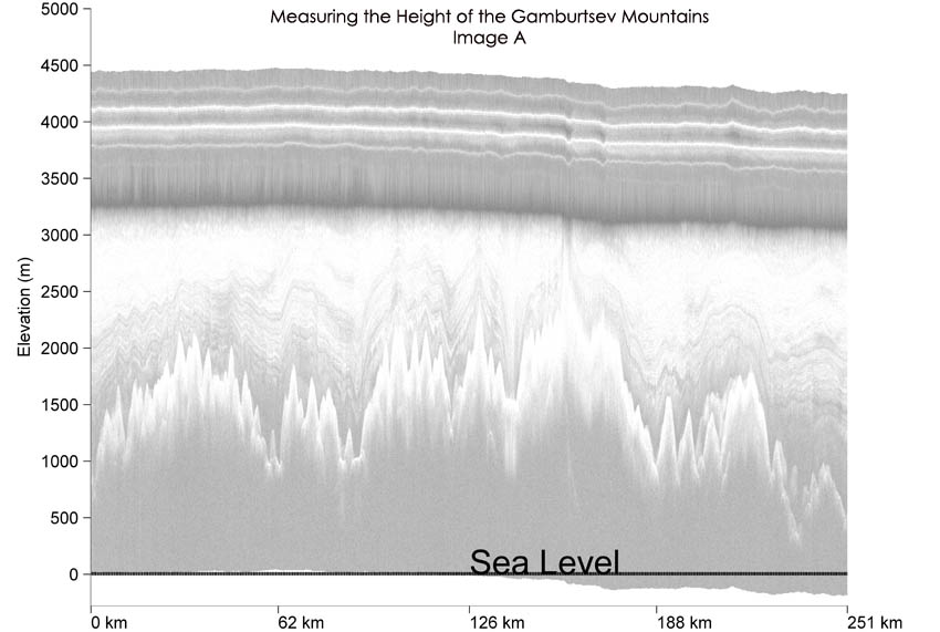
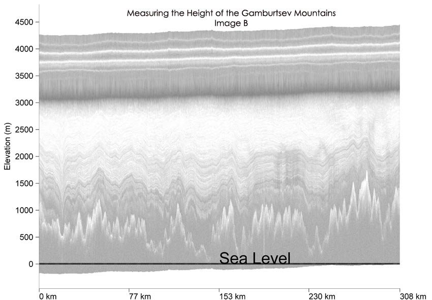
 First let's look at the 3 images of radar data, Mountain Sections A, B, and C. Click to enlarge each radar image and using the Y axis measure how high the tallest peak in each image rises above sea level.
  You can check the height of these peaks from the Gamburtsev's against the highest peak in your own state using this
 How do the Gamburtsev peaks compare to peaks in your area?
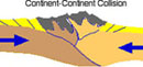
 How do we measure a mountain's height? When we talk about the height of a mountain we are talking about measuring from sea level up to the tip of the peak. It might surprise you to know that sea level can be different around the globe due to variations in gravity. Scientists account for this by calculating an average ocean height. This is what is referred to a '0' elevation or sea level for our measurements. Often the mountains being measured are far removed from the sea but the measuring always starts at sea level elevation.
 In activity 2 we looked at the overall size of the Gamburtsev mountain range, but what about the height of some of the individual peaks? How high are some of these compared to other peaks you have read about? How high are these peaks compared to a mountain peak in your area? The peak shown in this photo is called Finsteraarhorn. It lies in the Bernese Alps of Switzerland and measures 4,275 m in height. Click on the image to get a sense of how impressive the peak height is as you see it rise above the ground. The Gamburtsevs have been buried under ice for so long that we have no photograph like this to look at...BUT we do have images from the radar data that we can use to determine their height. Let's see how they measure up! Go to 'Try the Activity'.
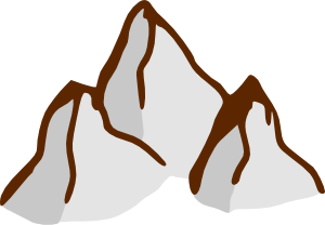
Please use these images for the "How Tall are These Mountain Peaks" Activity
 |
 |
 |
|---|---|---|
Click to Enlarge Mountain Section A |
Click to Enlarge Mountain Section B |
Click to Enlarge Mountain Section C |
Student Activity Worksheet
download response sheet word pdf