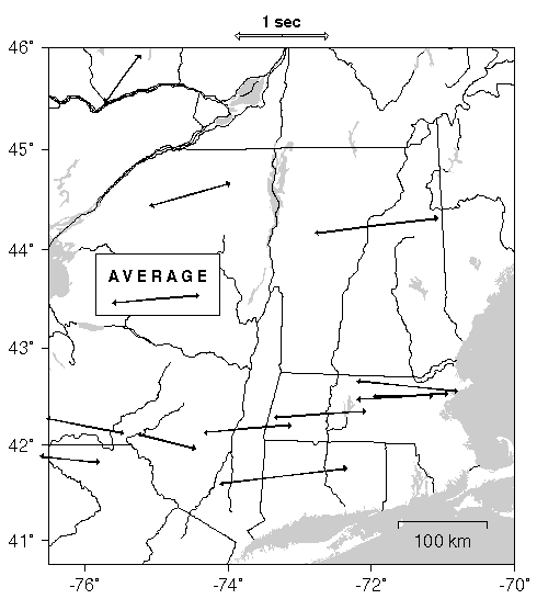
Fig. 5. Map of NE Appalachian region, with "average" parameters of seismic anisotropy plotted at points where they were constrained by various workers. Arrow azimuths correspond to the fast directions determined for the particular site, and are scaled with estimated delay. The compilation is based on data from the "Anisotropy Resource Page" maintained by Derek Schutt http://darkwing.uoregon.edu/~schuttd/aniso_source.html). Individual values are from Silver and achan [1991], Bostok and Cassidy [1995]], Barrout et al. [1997] and Fouch et al. [1999]. (Postscript version)