Introduction and Description of Experiment
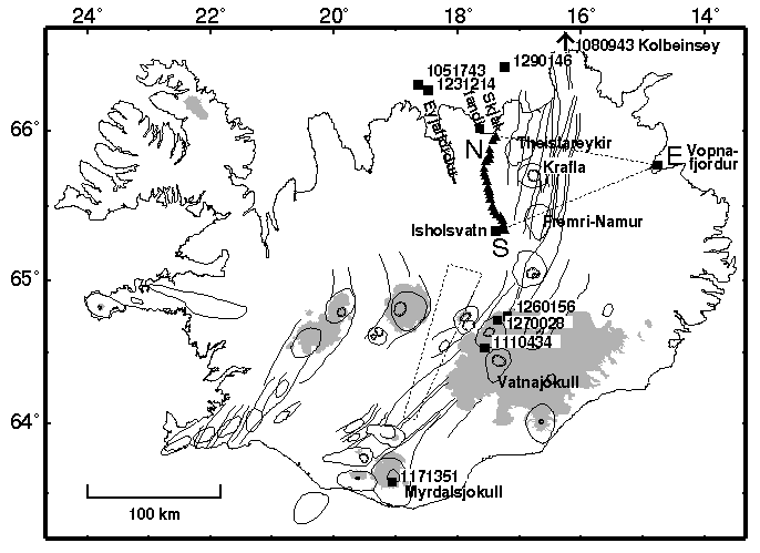
Fig 1: (left) Map of Iceland, showing locations of seismometers of the B96 array (triangles), central volcanos (cirular outlines), fissure swarms (line segments), glaciers (shaded regions), and shot and earthquake locations (squares). (PostScript version of map).
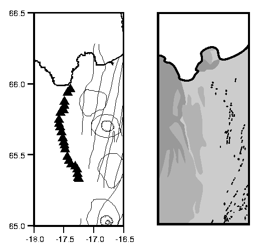
Fig 2: (left) Map of Northern Volcanic Zone (NVZ), Iceland, showing locations of seismometers of the B96 array (triangles), central volcanos (cirular outlines) and fissure swarms (line segments). (right) Geological age map: >3.1 Ma (dark gray), 3.1-0.7 Ma (medium gray) and (<0.7 Ma) rocks are shown. Sites of historical erruptions (line segments) are also shown. The B96 array is located in a glacial valley just west of the western edge of the NVZ> (PostScript version of map).
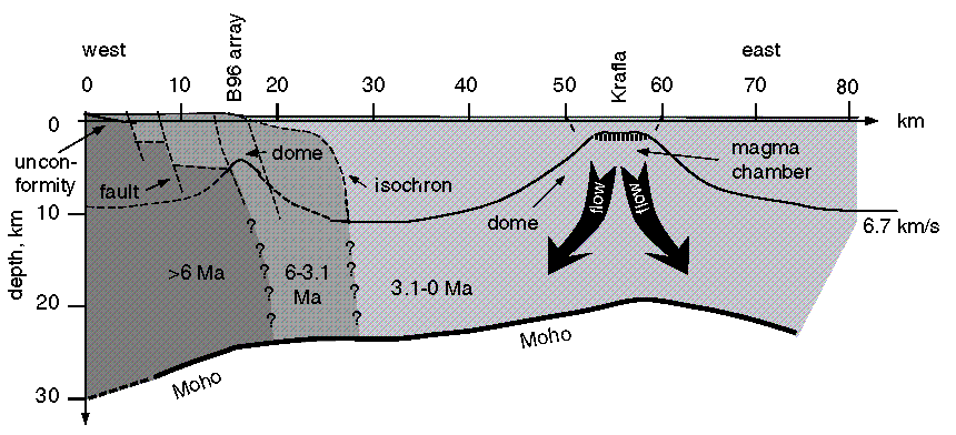
Fig 3: Interpreative tectonic cross-section. Known (solid) and hypotehtical (dashed) geologic boundaries are shown. (PostScript and IslandDraw versions).
Summary
Instrumentation. The B96 array consisted of 25 3-component, digital seismic stations, named b1 through b25 (south to north). Stations b2-b23 used Mark Product short period L22-D geophones. Station b1 used a STS-2 broadband geophone. Station b25 used a CMG40-T broadband geophone. All data was recorded using REFTEK Data Aquisition Systems with at a sampling rate of 50 sample/s (station locations as tab-separated table).
Time Period.April-May, 1996.
Location. The array was deployed along the eastern side of Bardardalur, a NS-striking glacial valley in northern Iceland (Fig 1). Station b1 was at the farm Svartarkot and b25 at the farm Laxamyri. Bardardalur is just west of the Northern Neovolcanic Zone, the divergent plate boundary in northern Iceland.