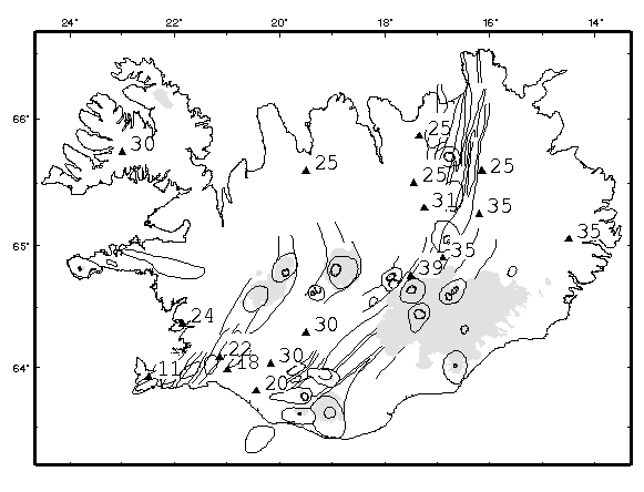
Map of Iceland , showing central volcanos (circular outlines), associated fissure swarms (curved lines), glaciers (shaded regions) and seismological measurements of depth to Moho (triangles, with anotated depth in kilometers). (PostScript version).