|
 |
|
|---|
Local Fjords
Leveraging Local Knowledge to Measure Greenland Fjords
Science Plan
Lamont-Doherty Earth Observatory
Science Plan
|
|---|
| Click on the image to enlarge |
Study Location
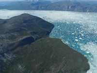
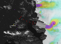
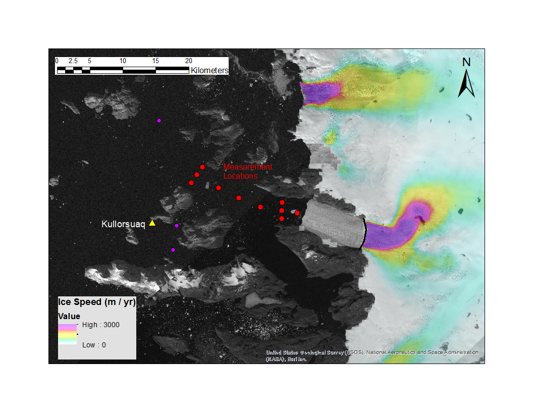
The focus of our research is a tidewater glacier on the northwest coast of Greenland called Alison glacier. In this satellite image Alison is the southernmost of the two glaciers shown here. This is a velocity map, with the colors representing the speed of the ice movement. The purple colored centers are the fastest moving sections on the two glaciers shown with ice moving at rates up to 3000 m/yr (click image to enlarge). You will see that Alison has a much larger section of fast moving ice than Hayes glacier which is shown to the north in the satellite image. If you click to enlarge the image you will see a black line drawn on Alison just where the velocity coloration starts. This line marks the glacial grounding line, that place where the ice transitions from floating to being frozen to the bed. In front of the grounding line the ice is floating, often called a floating ice tongue. The red dots mark locations for planned CTD casts (see section below) for water measurements. The two southernmost purple dots are additional CTD casts if time permits which will be used in order to calculate the full heat budget for water entering this embayment. The northernmost purple dot is believed to be located in a trough that funnels water to another glacier. If time permits a sample will be collected for comparison.
Collecting water measurements in front of Alison will allow us to compare water temperatures to Upernavik and Jakobshavn, two of Greenland's other west coast tidewater glaciers undergoing change.
 |
|---|
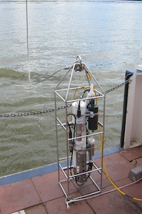
| Instrument for measuring ocean conductivity (salinity), temperature, depth (CTD) |
Collecting Ocean Measurements
The instrument pictured here is a CTD which stands for conductivity (used to calculate salinity), temperature and depth. Physical oceanographers use this instrument to collect water property information and to examine how salinity (conductivity) and temperature vary by depth and by location. Salinity measurements combined with temperature measurements can be used to determine ocean water density, a primary driving force for circulation and currents.
The instrument is a collection of small probes, each measuring a different water property. By lowering the instrument over the side of a boat you cancharacterizing the water column by the information collected as the instrument lowers . The project plan calls for a series of CTD measurements to be collected along a transect in front of Alison glacier as well as a measurement at each water pathway into the fjord. This series of measurements will provide a fjord heat budget and some additional ocean current and circulation information.
![]()
This project is funded through LDEO Climate Center with additional funding from NASA Interdisciplinary Program & logistical support from NSF. | contact us | web master