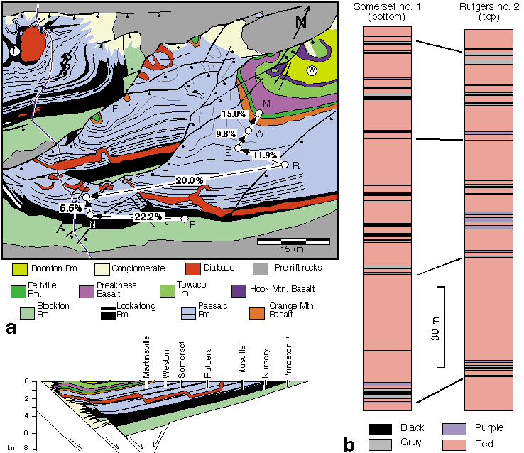
| Figure 1: a. Geologic map of the north-central part of the Newark basin showing the locations of the seven NBCP drill sites. Schematic cross section shows offset coring technique; marker unit at the base of one core correlates with same marker unit at top of adjacent core. Arrows on geologic map indicate the amount of thickening between overlap sections of stratigraphically adjacent cores based on correlations in Olsen et al. (1996a). Abbreviations for drill holes are: M, Martinsville; N, Nursery; P, Princeton; R, Rutgers; S, Somerset; T, Titusville; W, Weston. Other abbreviations are: F=Flemington fault; f=Ferndale folds; H=Hopewell fault; w=Watchung syncline. b. Overlap section of the Rutgers and Somerset cores, showing pronounced increase in thickness and proportion of deeper-water mudstones (gray and black units) from Rutgers to Somerset. Based on data in Olsen et al. (1996a). |
 |