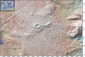
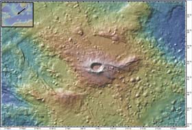
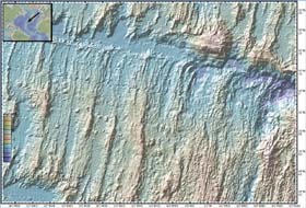
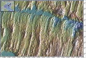
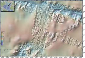
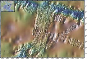
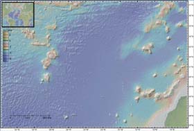
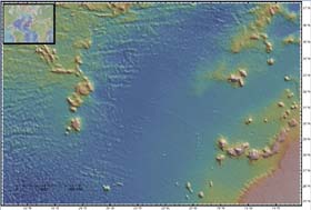
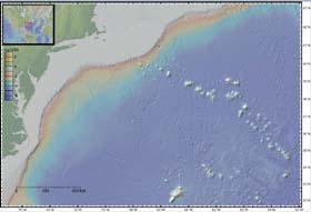
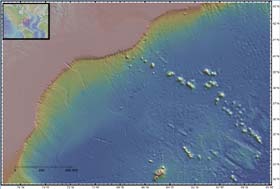
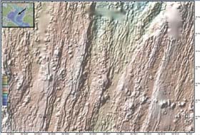
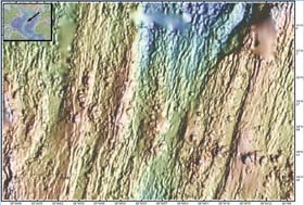
Atlantic Ocean Seamounts Most of the seamounts in the Atlantic basin are associated with hotspots beneath the slow moving African, Eurasian, North and South American plates. Very few seamounts form near the slow spreading Mid-Atlantic ridge although many small vocanoes form near the ridge axis. The parallel lineated features formed by faulting at the ridge axis are abyssal hills. Each shaded relief image below shows color coded depth combined with a false illumination to highlight fine scale texture. The large area maps are based on predicted bathymetry derived from a combination of altimetric satellite gravity and shipboard sonar measurements. The more detailed images are derived from multibeam swath sonar depth measurements collected by research vessels. The sonar swaths are superimposed on the smoother predicted bathymetry. The less saturated, images use the same depth/color scale indicated on the color bar. The more saturated images each use a different depth/color scale optimized for that seamount. These images were generated with Bill Haxby's GeoMapApp tool. |