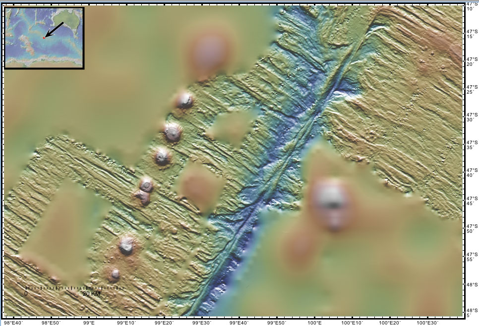
| Wollunka Transform Ridge This sonar image shows a chain of ~2000 meter high seamounts adjacent to the Erathipa transform. The smoother satellite-derived predicted bathymetry shows a much larger seamount on the eastern side of the transform outside the sonar swath. The seamounts were recently formed near the spreading center where new seafloor is being created by the NE-SW divergence of the Australian and Antarctic tectonic plates. A more detailed explanation of the origin of these features is given in the regional tectonic overview. A more detailed explanation of the sonar image is given on the Gallery page. These sonar data were collected in 1994 by the R/V Melville.
The names of these seamounts are based on Australian Aboriginal mythology and are provisional pending approval. |