
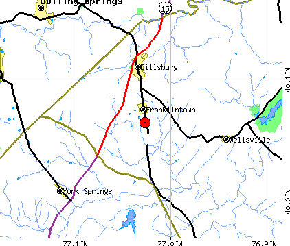
| Region: Dillsburg, Pennsylvania |
| Date-Time: 2009-04-24, 05:36:48.8 (UTC) |
| Date-Time: 2009-04-24 01:36:48.8 (EDT) |
| Magnitude: 2.9 (Mc - Coda Duration) |
| Latitude: 40.064 N |
| Longitude: 77.026 W |
| Depth: 1.5 km |
| |
|
| |
|
|
 |
Recent Dillsburg, York County, Pennsylvania earthquake sequence has been relatively
poorly recorded by regional and national seismographic network stations when compared with
other earthquakes that occurred in the northeastern United States.
There are only four stations within 100 km from the epicenter and the nearest
station, MVL (Millersville University),
was about 53 km away from the epicenter (see the map above).
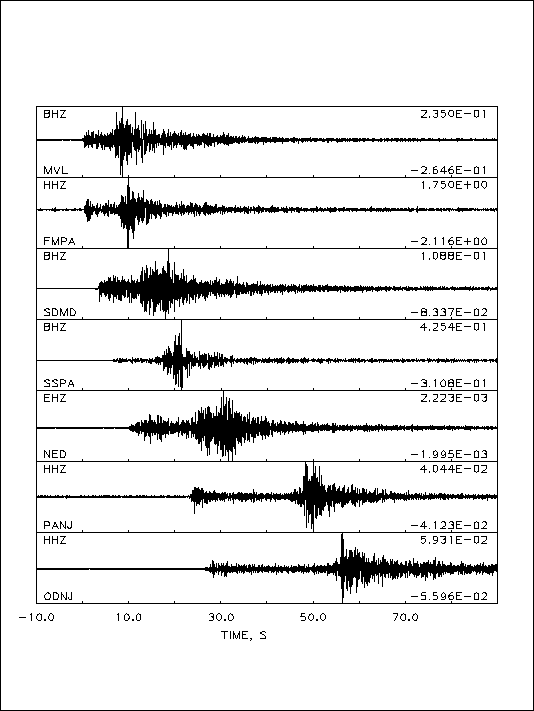
Hence, the location of the largest shock (mainshock) on 10/10/2008 at
04:22:07 EDT as well as much smaller foreshocks and aftershocks
were poorly determined, which can be seen from the widely scattered
epicenters of those earthquakes. Usually, foreshocks, mainshock and
aftershocks of such small sized earthquake sequence will occur very close
to each other as a "cluster".
24 small earthquakes that occurred around Dillsburg since Oct. 5th, 2008 until
Apr. 24, 2009 are plotted with red circles. The circle size is proportional
to magnitude of each event.
The permanent seismographic stations of the LCSN are plotted with solid triangles: MVL (Millerville University), FMPA (Franklin and Marshall College). Other earthquakes that occurred in the region are plotted with open circles. The largest event was magnitude 4.1 that occurred on 04/23/1984 in Lacaster seismic zone.