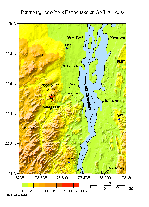
Here is a list of earthquakes that have occurred since April 20, 2002, near
Au Sable Forks, New York about 29 km southwest of Plattsburgh, NY. |
| Date | Origin Time (UTC) | Time (EDT) | Latitude (N) | Longitude (W) | Depth (km) | Magnitude (ML, Richter) |
Remark |
| 2002/04/20 | 10:50:47.5 | 06:50:47.5 | 44.513 | 73.699 | 11 | 5.3 | Mainshock |
| 2002/04/20 | 11:04:42.4 | 07:04:42.4 | 44.490 | 73.690 | 5 | 3.7 | aftershock |
| 2002/04/20 | 11:08:26.0 | 07:08:26.0 | 44.501 | 73.704 | 5 | 1.7Mc | aftershock |
| 2002/04/20 | 11:45:28.7 | 07:45:28.7 | 44.504 | 73.703 | 5 | 2.6 | aftershock |
| 2002/04/21 | 11:47:09.9 | 07:47:09.9 | 44.515 | 73.669 | 10 | 2.2Mc | aftershock |
| 2002/04/21 | 12:39:10.7 | 08:39:10.7 | 44.504 | 73.700 | 5 | 2.3Mc | aftershock |
|
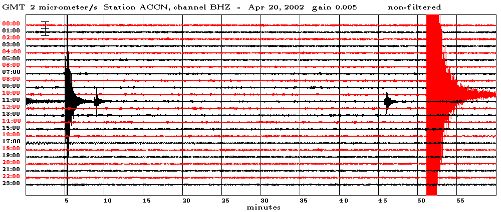
Broadband, Vertical-component seismic record at ACCN (distance=126 km) in the Adirondacks. Mainshock and three aftershocks can be identified.
 |
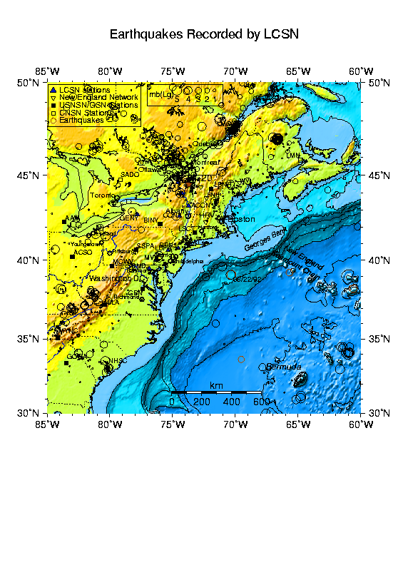
Locations of the seismographic stations in the NorthEastern U.S. region. Mainshock on April 20, 2002 is indicated by a star (red).
 |
 |
Source mechanism of the Au Sable Forks, New York earthquake determined by using seismic signals recorded at regional distance (from 144 to 1250 km). Waveform data are used to determine focal depth and source mechanism parameters using moment tensor inversion method. Source mechanism indicates predominantly thrust motion along 45 degree dipping fault plane striking due South (aftershock distribution indicates that fault plane dips due West).
Finding the best fit Focal Depth using Moment Tensor inversion technique
Harvard Centroid Moment Tensor Solution
P wave First Motion Plot by J. Ebel at Weston Observatory, MA
Recent Earthquakes in the NorthEastern U.S. and southeastern Canada, 1970-2000.
Compiled by Won-Young Kim
at Lamont-Doherty Earth Observatory of Columbia University