|
Malaysia Natural Disaster Profile
Basic Facts:
|
Area:
329,750 km2
Coastline:
4,675 km
Population:
23,522,482
|
GDP (PPP):
$207.8 billion
GDP
Per Capita: $9,000
Population Below Poverty Line:
8%
|
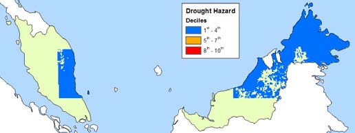
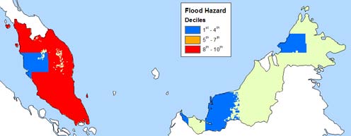
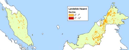
Natural Disaster Risk Hotspots
Click on individual images for larger
view
 |
|
 |
|
 |
| |
|
|
|
|
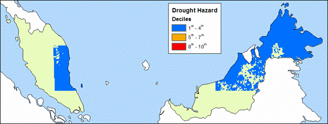
| Droughts |
|
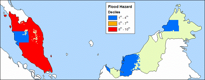
Floods |
|
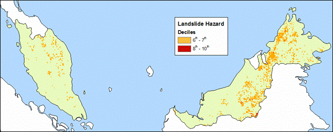
Landslides |
Natural Disaster Risk Hotspots (Weighted
by Mortality)
Click on individual images for larger
view
 |
|
 |
| |
|
|
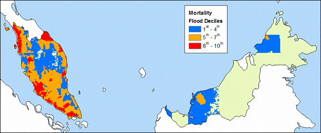
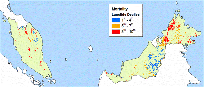
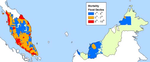
| Floods |
|
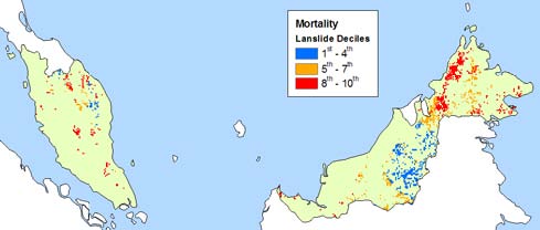
Landslides |
EM-DAT Information (1965 - 2004)
| Disaster |
# of Events |
Total Killed |
Avg. # Killed |
Total Affected |
Avg. # Affected |
| Cyclone |
6 |
294 |
49 |
55,805 |
9,301 |
| Drought |
1 |
0 |
0 |
5,000 |
5,000 |
| Earthquake |
- |
- |
- |
- |
- |
| Flood |
24 |
243 |
10 |
899,620 |
37,484 |
| Volcano |
- |
- |
- |
- |
- |
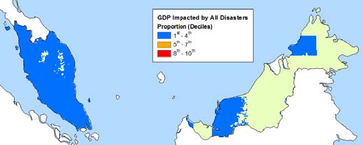
Natural Disaster Risk Hotspots (Weighted
by Proportion of GDP Impacted)
Click on individual images for larger
view
 |
| |
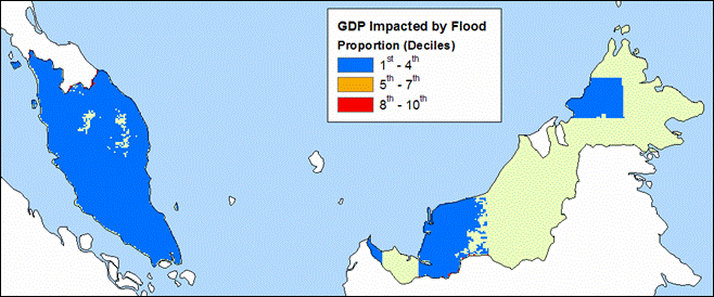
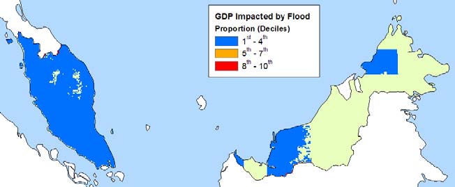
| Floods |
Demographic Information:
Population within 1km
of coast |
Population within 2km
of coast |
Infant Mortality Rate
|
297,579 |
599,790 |
18.35 |
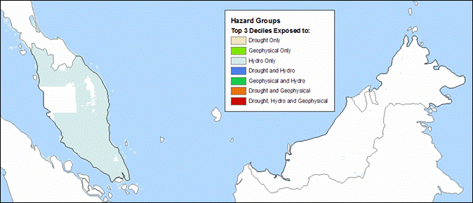
Multi-Hazard Disaster Risk Hotspots
(All Hazards combined and weighted by Mortality and Proportion
of GDP Impacted)
Click on individual images for larger
view
 |
|
 |
| |
|
|
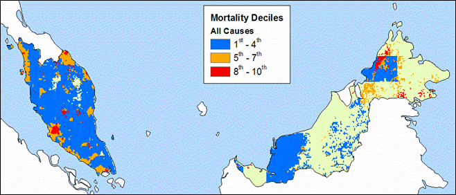
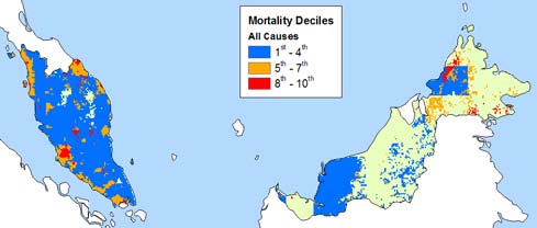
| Mortality |
|
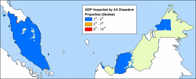
GDP |
Multi-Hazard Disaster Risk Hotspots
by Hazard Groups (Top Three Deciles)
Click on individual images for larger
view
Observations
Floods are the primary hazard affecting
Malaysia, ranking in the top deciles for most of the western
half of the country. Landslides and droughts are also significant
though their effects are limited to much smaller areas in
the eastern regions. When weighted by mortality, landslides
pose a large risk for the northeastern part of the country.
The hazards affecting the western region are distinctly different
than those impacting the eastern areas.
|