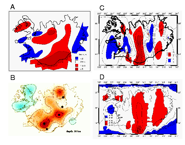
Iceland Results
- Figure Comparison of A) Palmasson's (1972)
map of the depth to the 6.5 km/s layer. Warm colors indicate deeper depths.
B) Allen's (2001) shear velocity anomaly at 10 km depth. Warm colors indicate
slower velocities. C) My redo of Palmasson's map, adding new refraction
data (i.e. from SIST, KATLA, FIRE, ICELINE, B96 and RISE) and using automated
gridding. D) The P velocity at 10 km depth, based on my recompilation.
Warm colors indicate lower compressional velocities. Note the general
similarity of the four maps. (PostScript Version).
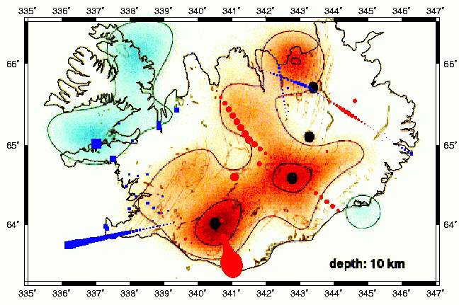
- Figure P wave velocity data (red and blue
symbols) overlaid onto Allens shear wave velocity map. P wave data are extracted
from my recompilation at 10 km depth. Symbol size scales with P velocity above
(blue) and red (below) 6.65 km/s. (PostScript Version).
Data
P wave point data, 10 km below sea level
P wave point data, 10 km below surface
References
Allen, Richard, The mantle plume beneath Iceland and
its interaction with the north Atlantic ridge: a seiosmological
investigation, Ph.D. Thesis, Princeton University, 2001.
Palmasson, G., Crustal structure of Iceland from explosion
seismology, Societas Scientiarum Islandica, Reykjavik, 1972.