Morphology and Glacial Processes of the Antarctic Continental Margin
Detailed bathymetry of the Antarctic continental margin can reveal pathways of sediment and water transported beneath former ice sheets and allows reconstruction of ice flow. I am involved in various activates to compile and analyze bathymetric data from all around Antarctica. Much of the work has been focused on the Amundsen Sea in West Antarctica.
Paleo ice flow and subglacial meltwater dynamics in Pine Island Bay, West Antarctica
Increasing evidence for an elaborate subglacial drainage network underneath modern Antarctic ice sheets suggests that basal meltwater has an important influence on ice stream flow. Swath bathymetry surveys from previously glaciated continental margins display morphological features indicative of subglacial meltwater flow in inner shelf areas of some paleo ice stream troughs. Over the last few years several expeditions to the eastern Amundsen Sea embayment (West Antarctica) have investigated the paleo ice streams that extended from the Pine Island and Thwaites glaciers. A compilation of high-resolution swath bathymetry data from inner Pine Island Bay reveals details of a rough seabed topography including several deep channels that connect a series of basins. This complex basin and channel network is indicative of meltwater flow beneath the paleo-Pine Island and Thwaites ice streams, along with substantial subglacial water inflow from the east. This meltwater could have enhanced ice flow over the rough bedrock topography. Meltwater features diminish with the onset of linear features north of the basins. Similar features have previously been observed in several other areas, including the Dotson-Getz Trough (western Amundsen Sea embayment) and Marguerite Bay (SW Antarctic Peninsula), suggesting that these features may be widespread around the Antarctic margin and that subglacial meltwater drainage played a major role in past ice-sheet dynamics.
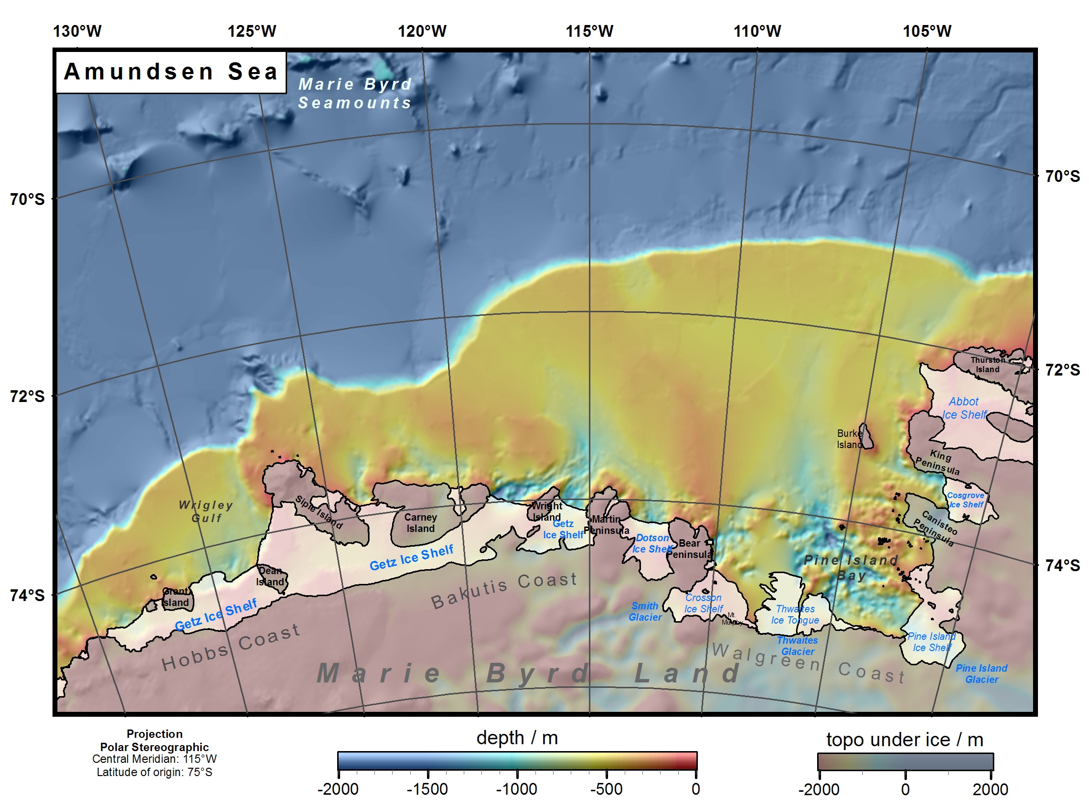
New Bathymetry Map of the Amundsen Sea, West Antarctica
The Amundsen Sea continental shelf is one of the remotest areas of coastal Antarctica, and was relatively unexplored until the late 1980s. Over the last two decades, increased oceanographic and geological interest has led to several cruises that resulted in sufficient bathymetric data to compile a fairly detailed regional map of the Amundsen continental shelf.
The glaciers and ice streams that end in the Amundsen Sea are thinning faster then other glaciers in Antarctica and one hypothesis relates this thinning to enhanced melting of the glaciers and ice shelves in this area. This melting could be caused by warmer ocean water that enters onto the shelf and is trapped in deep troughs under the ice shelves.
During several scientific expeditions over the last few years a significant amount of new bathymetry data were collected.
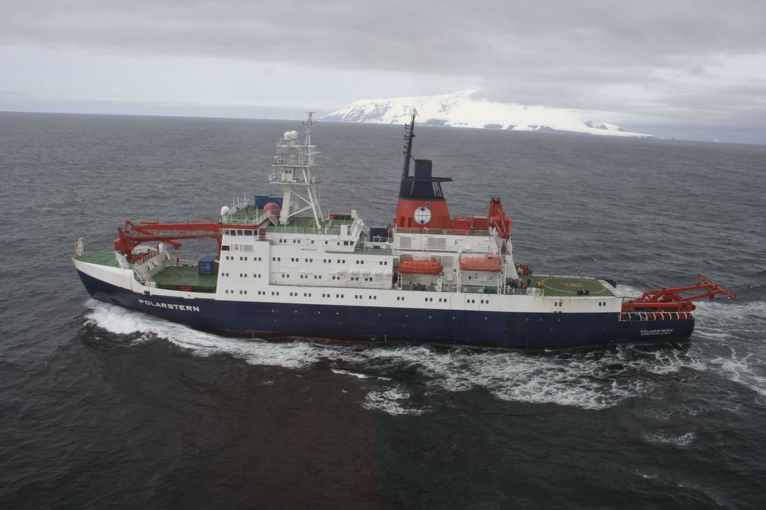
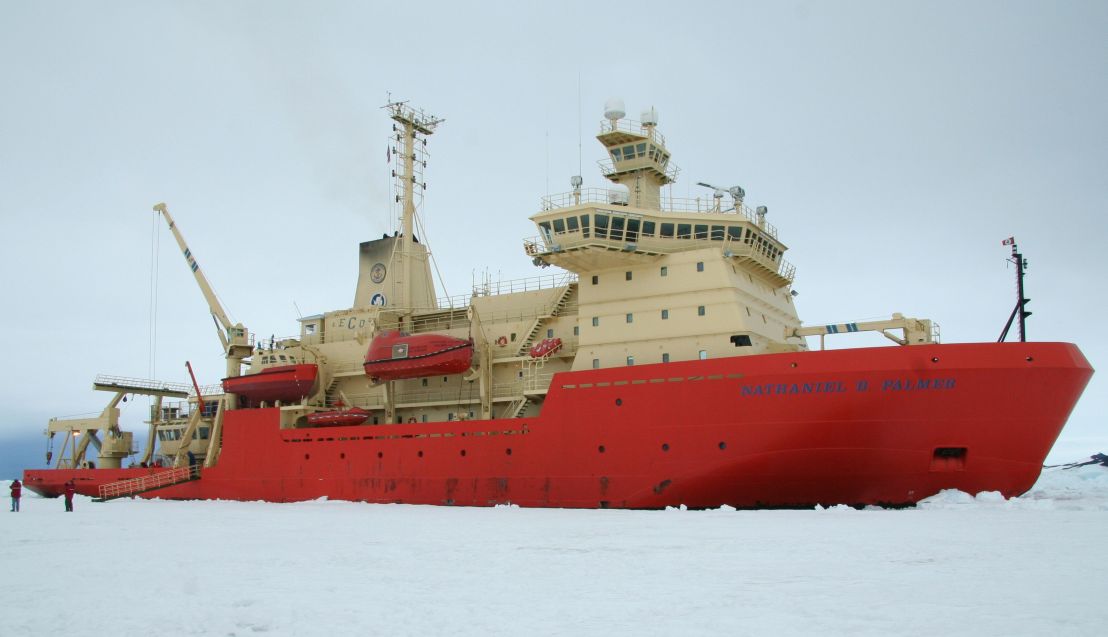
Research icebreaker Polarstern (left) and NB Palmer (right)
In 2006 and 2007 I participated on two expeditions with the German research vessel Polarstern (2006) and the American ship NB Palmer (2007). To see impressions of these two successful expeditions follow the link below.
Impressions from the 2007 expedition (NBP07-02) with NB Palmer.
Based on the new multibeam bathymetry data and combining other available older bathymetry and echosounding data from this area we created a new bathymetry map of the Amundsen Sea.
For a detailed description see:
- Nitsche, F.O., Jacobs, S., Larter, R.D. and Gohl, K., 2007
Bathymetry of the Amundsen Sea Continental Shelf: Implications for Geology, Oceanography, and Glaciology. Geochemistry, Geophysics, Geosystems,8: Q10009, doi:10.1029/2007GC001694.
Data:
Gridded bathymetry data of this map can be accessed through the Antarctic multibeam synthesis database.
The map is also available as a GoogleEarth overlay in form of AmundsenBathymetry.kmz file.
International Bathymetric Chart of the Southern Ocean
The objective of the International Bathymetric Chart of the Southern Ocean program is to gain better knowledge of the sea floor topography in the Southern Ocean. For that reason the IBCSO group collects and compiles bathymetric data from hydrographic offices, scientific institutions and data centers to create the first regional digital bathymetric model that covers all circum-Antarctic waters. The digital bathymetric model of IBCSO Version 1.0 has a 500 m x 500m resolution based on a Polar Stereographic projection with true scale at 65° S and covers the area south of 60° S.
For more details see www.ibcso.org
Collaborations:
- Alfred Wegener Institute for Polar and Marine Research
- British Antarctic Survey
- Scott Polar Research Institute
- Antarctic Multibeam Bathymetry and Geophysical Data Synthesis
- Funded by NSF