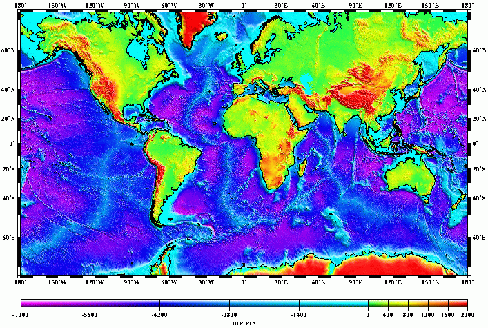
Image resolution 15'

Submarine elevations based on Scripps/NOAA
predicted bathyrmetry derived from Geosat, ERS-1 & Topex/Poseidon
Satellite altimetry.

Last Modification: June 15, 1997
Images rendered by small@ldeo.columbia.edu
using GMT
software.