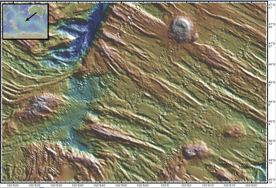
| Wuluwaid Seamount and Ungud Transform Deep This sonar image shows a 800 m high seamount on the south flank of the Southeast Indian Ridge. The sharp bends in the abyssal hills mark the spreading center offset at the Ungud Transform. The seamount was recently formed near the spreading center where new seafloor is being created by the NE-SW divergence of the Australian and Antarctic tectonic plates. A more detailed explanation of the origin of these features is given in the regional tectonic overview. A more detailed explanation of the sonar image is given on the Gallery page. These sonar data were collected in 1994 by the R/V Melville.
The names of these seamounts are based on Australian Aboriginal mythology and are provisional pending approval. |