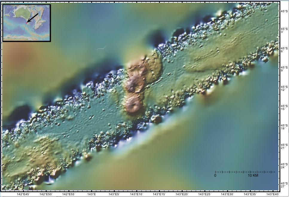
| Wati-kutjara Seamounts This sonar image shows the 700 m Wati-kutjara abyssal seamounts at the foot of the Tasman Rise. These features were formed many millions of years ago near the spreading center where new seafloor was being created by the NE-SW divergence of the Australian and Antarctic tectonic plates. A more detailed explanation of the origin of these features is given in the regional tectonic overview. A more detailed explanation of the sonar image is given on the Gallery page. These sonar data were collected in 1994 by the R/V Melville.
The names of these seamounts are based on Australian Aboriginal mythology and are provisional pending approval. |