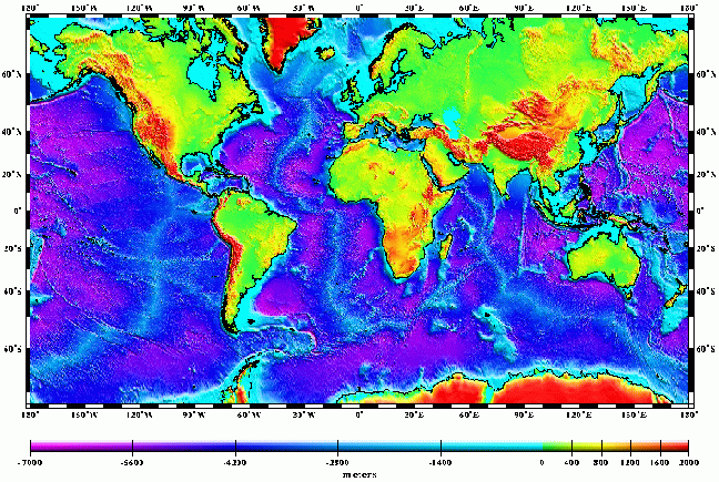
Global Digital Elevation Model
Continental hypsography (that is, distribution of area by altitude) is derived from global, 30 arc sec (30") gridded elevations provided by the EROS Data Center , Sioux Falls, SD. The 30" elevation model derived from DMA map products and DMA DTED Level 1 (3") gridded topography covers North and South America, Africa, Europe, Asia, Australia, and Oceania as well as Greenland and Antarctica [Danko, 1992; Defense Mapping Agency, 1986].