High Spatial Resolution Urban Mapping
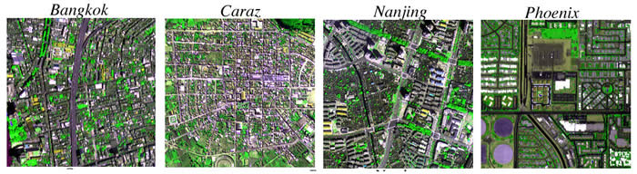
Autocorrelation analyses of 1 m Ikonos panchromatic imagery in 14 cities quantify characteristic
spatial scales of urban mosaics. Comparative spectral mixture analyses show stronger linear mixing
and consistent spectral endmembers with moderate resolution Landsat mixture analyses. Details in:
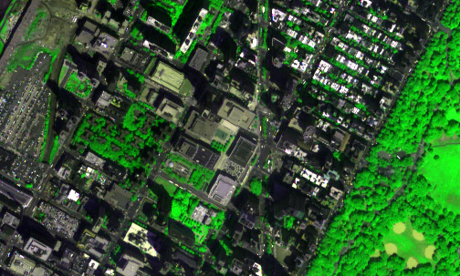
High spatial resolution patch size analysis of segmented urban vegetation
fraction maps quantifies scale distribution and connectedness of urban vegtation.
Details in: