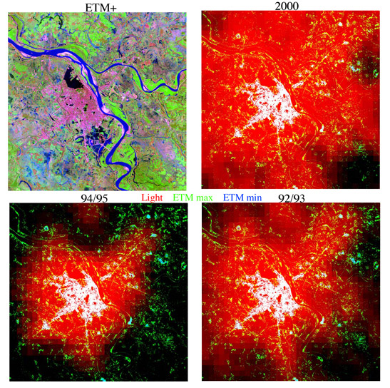
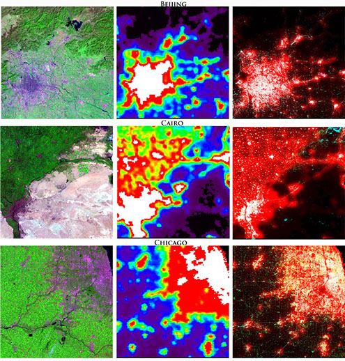
Global Spatial Analysis of Stable Night Lights
Global spatial analysis of 1992/93, 1994/95 and 2000 DMSP night lights
suggests consistent scaling across a wide range of city sizes. Comparison
with Landsat 7 imagery in 17 cities worldwide quantifies spatial extent of
overglow and no consistency in frequency detection threshold area reduction.
Comparison with island periphery overglow suggests a quasilinear relationship
between illuminated area and lateral extent of overglow. Details in:
Zipf City
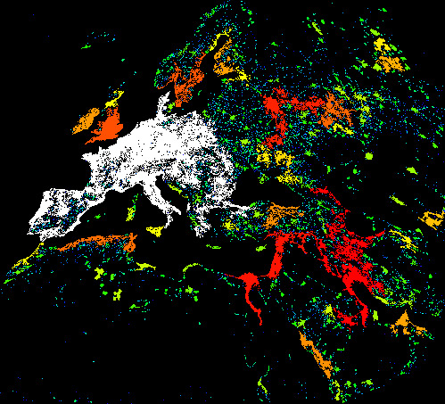
Zipf’s Law states that rank-size distributions of city populations follow a power law with an exponent of -1.
The assertion of a universal power law is controversial because the linearity and slope appear to vary over
time and among countries. These inconsistencies arise, in part, from administrative fragmentation of spatially
contiguous agglomerations. The issue is also complicated by the lack of any widely accepted metric for
delimiting urban extent. We attempt to circumvent both of these issues by treating urban extent as a continuous
variable. We test Zipf’s Law for area distributions using subsets of continuous spatial proxies for human settlements:
population density, night light brightness and urban land cover. At both continental and global scales, spatial segment
size distributions of population density and night light brightness are well fit by power laws with exponents progressively
spanning -1 for a wide range of density and brightness thresholds. However, the large agglomerations resulting from the
segmentation are far larger than individual cities— they correspond to extensive (> 105 km2) spatial networks but are nearly geographically
exclusive for night light and population.
Currently under review