
Kim Anne Kastens, E&ESJ Co-Director
Professional Interests
My training and early career were in the field of marine geology. I worked to understand the tectonic and geological evolution of the Mediterranean region, and to unravel the sequence of events and underlying processes leading towards a massive continent-continent collision between Africa and Eurasia. To this end, I used deep-sea drilling to reconstruct the growth history of the Tyrrhenian Basin, high-resolution seafloor mapping and sampling to document compressional deformation across the Mediterranean Ridge, and Global Positioning System geodesy to measure active deformation in the Aegean Basin. A second line of research concerned the structure and tectonics of oceanic transform faults. My goals were both to understand how strike-slip plate boundaries develop and evolve, and also to take advantage of the perturbation introduced by the transform boundary to learn about the fundamental accretion processes and architecture of the oceanic crust. These inquiries lead me to the Tamayo, Siqueiros and Clipperton transform faults in the Pacific, and to the Vema Fracture Zone in the Atlantic. All told, I led or participated in 26 major oceanographic research cruises, and 3 GPS geodesy campaigns.
For the last ten years and into the foreseeable future, my professional goals center around improving the public's understanding and appreciation of Earth systems. I am engaged on four fronts, working to reach the public and improve geoscience learning through: (1) journalists, (2) teachers, (3) information technology, and (4) geoscience education research.
- Journalists:
- Teachers:
- Instructional Technology:
- Use of real data in Earth Education. One of the opportunities that technology opens up is the delivery of significant data sets into the hands of learners. Most pre-graduate-school education involves learning from human beings, or from artifacts created by human beings such as books or computer programs. Working with real data offers the possibility of a fundamentally different mode of learning: learning direct from nature. With funding from the Dalton School and NSF's Awards to Facilitate Geoscience Education, Dalton teachers and I developed a set of field-based investigations for students to carry out at Black Rock Forest, plus a suite of computer-aided investigations based on data from Black Rock's environmental sensor network. As a component of the Marine Data Management System, and in collaboration with DLESE’s Data Access Services group, I ran a workshop and follow-up coaching to help teachers and faculty members develop data-rich activities using data from mid-ocean ridges.
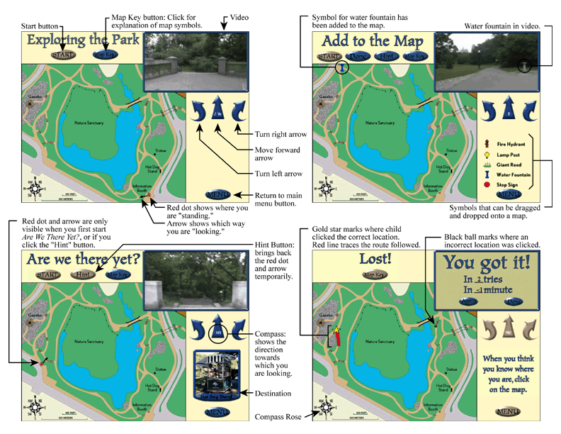
- "Where are We?" Project: Translation from Reality to Schematic Representations: One category of learning task on which technology brings high added value is in translating from one representation of reality to another. This includes translating from one language to another, from audibly-sensed music to musical notation, from a holistically-sensed situation into an equation, and from a visually-perceived landscape to a map. In collaboration with colleagues at the Institute of Learning Technologies, Teachers College, and with funding from NSF's Instructional Materials Development Program, I have developed software to help elementary school children learn to "translate" back and forth between their visually-perceived environment and a map. Where are We? and its Spanish language counterpart, ¿Dónde Estamos?, are in commercial distribution through Tom Snyder Productions.
- Digital Library for Earth System Education: Pooling best resources and best practices in geoscience education: Education has long functioned as a cottage industry, in which individual craftspeople handcraft individual products for distribution to their local communities. The advent of the National Science/Math/Engineering/Technology Digital Library (NSDL) and its component Digital Library for Earth System Education (DLESE) hold out the potential of a fundamental paradigm shift, in which educators craft educational resources in their area of greatest expertise and interest, and draw upon a national library of high-quality, rigorously-reviewed learning and teaching materials for teaching and learning about other topics. As part of a nation-wide collaboratory to build these digital libraries, my responsibility is to develop the Community Review System. The CRS collects feedback and reviews from learners and educators who have used DLESE resources. We then digest and disseminate this information for prospective users to decide whether and how to use the resource, resource creators to improve their resource, and DLESE editors to decide which resources to showcase in the DLESE Reviewed Collection.
- Geoscience Education Research:
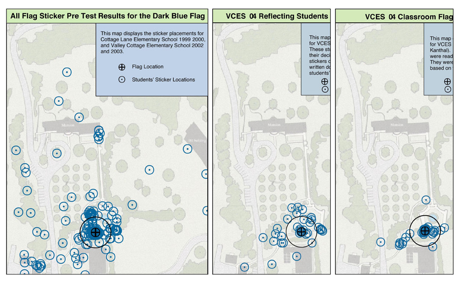
- Children's Map Skills: In collaboration with Lynn Liben, a developmental psychologist from Penn State, I am using the Where are We? software and field-based tests of map skills developed during the Where are We? project to document misconceptions and mistakes made by teachers and children as they "translate" between a map and a visually-perceived environment. We find two kinds of mistakes: those grounded in a failure to understand or use representational correspondence (the correspondence between a type of symbol on the map and a type of feature in the represented space), and those grounded in a failure to understand or use configurational correspondence (the correspondence between the relative placement of objects on the map and in the represented space.) Failures of representational correspondence, but not configurational correspondence, are greatly diminished by requiring children to reflect metacognitively on their reasoning as they do the field-based map task.
- Use of maps to communicate with policy makers: Toru Ishikawa, Tony Barnston, Patrick Louchouarn, Chet Ropelewski, and I are investigating how well the climate forecast maps produced by the International Research Institute for Climate Prediction [link to IRI] succeed in their goal of communicating complex information to climate stakeholders and decision-makers. Our preliminary results show that future policy makers accurately interpret the deterministic aspects of IRI’s suites of maps (e.g. how much rainfall occurred) but that errors are alarmingly common when they are asked more subtle questions about the probabilistic information on the maps ("The probability is ____% that Charleston, S.C. will receive less than ____mm of precipitation.").
- Visualizing 3-D structures in the field: Toru Ishikawa and I are studying how geoscientists and geoscience learners visualize a three-dimensional geological structure from the limited information available in the field. We have built a network of artificial plywood “outcrops” around the Lamont campus. We lead undergraduates around this network, encouraging them to record any information they think will help with the puzzle. We then ask them to choose from an array of 3-D models one which could represent the full buried “structure,” orient the model to the full-scale structure, and explain their reasoning. Our first surprising finding has been that a substantial minority of novices, in the absence of instruction, gravitate towards a verbal rather than a spatial or graphic approach to this problem, based on what they record as they observe the "outcrops."
Click image to enlarge
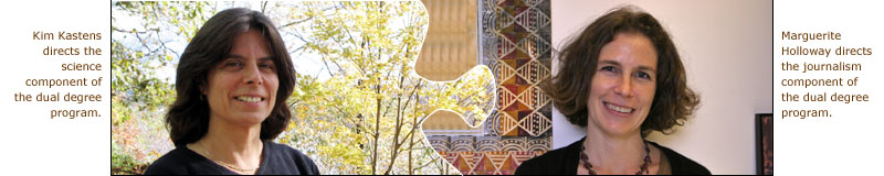
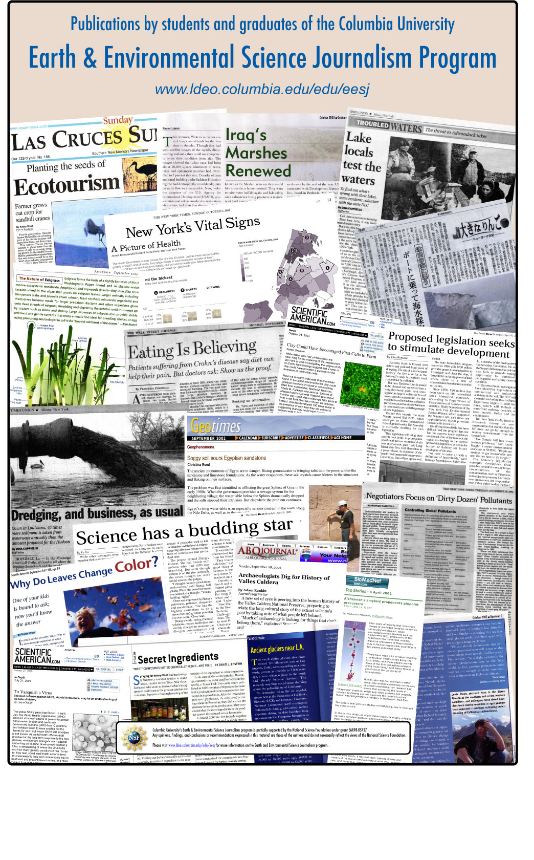
In our society, journalists are the educators who provide just-in-time-learning to political and business decision-makers, voters, and consumers. In pursuit of this journalist as informal science educator ideal, I established the Earth & Environmental Science Journalism dual masters degree program, in collaboration with the Columbia Graduate School of Journalism. The goal of this program is to produce graduates who will inform and challenge the public about discoveries, insights and ideas concerning the Earth and Environment, in a manner that is simultaneously interesting and accurate. The course of study comprises two semesters of coursework in science, a science research project, two semesters of coursework and practical training in journalism, and a journalism masters project. Graduates of the program are employed across the country in media organizations that reach science-oriented (eg. Scientific American, Geotimes), environment-oriented (eg. On Earth), and general (eg. Houston Chronicle, New York Daily News) audiences.
From 2000-2005, I ran a program to increase the quality, accuracy and visibility of environmental coverage reaching audiences that are currently underrepresented in geosciences. With funding from NSF's Program of Opportunities for the Enhancement of Diversity in the Geosciences, and working in collaboration with the Society of Environmental Journalists (SEJ), the Native American Journalists Association, the National Association of Black Journalists, and the National Association of Hispanic Journalists, this project awarded fellowships to attend SEJ meetings and trial memberships in SEJ to journalists of color, supported the co-development of sessions and fieldtrips on environmental topics at meetings of the minority journalists' associations, and fostered the addition of an "environmental" category to the awards programs of the minority journalists' associations.
Current and future teachers are the lever with which to reach the next generation of citizens and decision makers. To reach this audience, I have co-developed a course called "Teaching & Learning Concepts in Earth Science," which is taught to a mixed audience of Earth & Environmental Science PhD students who wish to teach geoscience at the college level, and Teachers College masters students who have some experience teaching Earth Science at the pre-college level. This course is focused on developing future faculty’s pedagogical content knowledge (PCK) in earth science. Pedagogical content knowledge means knowledge about how to teach a body of knowledge, skills and understandings, as opposed to knowledge of the discipline itself. PCK includes students’ prior ideas about aspects of the Earth, prerequisite skills and understandings underlying Earth Science concepts, use of analogies, metaphors and models to facilitate student thinking about earth science topics, use of inquiry, and assessment of student understanding. The course is cross-listed between the Department of Earth & Environmental Sciences and the Teachers College Department of Mathematics, Science & Technology, and co-taught by a professor from each of the sponsoring departments.
I am convinced that the use of computers and communication technology for helping teachers and learners will change education at all levels almost beyond recognition. Three avenues that I anticipate will be particularly fruitful are the use of real data in geoscience education, use of simulations to learn to "translate" from one representational domain to another, and use of communications technology to pool the best artifacts and best practices for geoscience education.
Click image to enlarge
Compared to physics education research or math education research, geoscience education research is in its infancy, and I am attempting to be one of the founders of this new field. My emphasis is on spatial thinking in the geosciences. Spatial thinking involves considering the shape, location, orientation, or configuration of objects or properties or processes, and using that spatial information to pose problems, formulate hypotheses or solutions, and communicate insights. Use of spatial representations, such as maps and cross-sections, is a component of spatial thinking.
Click image to enlarge
The Advancement of Women in Science
One other theme has run throughout my career: the advancement of women in science. I was one of the first two women to receive an undergraduate degree from the Department of Geology & Geophysics of Yale University, in 1975. In the early years of my career, I spent approximately three months at sea on research cruises where I was the only woman. I was the first female Co-Chief Scientist on the Joides Resolution, and the first woman to receive a professorial appointment (albeit adjunct) in ColumbiaÕs Department of Geological Sciences. As a member of the Lamont Executive Committee, I pushed through a stop-the-clock policy for the Senior Staff promotion considerations of scientists who take maternity leave. As Chair of Lamont's Promotions & Careers Committee, I spearheaded a revision of the promotions section of the Lamont by-laws to spell out aspects of the criteria and procedures that had been ambiguous or unwritten, motivated by the research finding that women are more likely to advance in organizations where the promotion procedures are transparent and uniform. As a member of Columbia's Commission on the Status of Women, I pushed through the partial leave of absence policy for Officers of Research who have children, and I was the lead author of the influential "pipeline report": Advancement of Women through the Academic Ranks of the Columbia University Graduate School of Arts & Sciences: Where are the Leaks in the Pipeline? As Co-Chair of the Commission on the Status of Women, I was among the group who advocated for the establishment the position of Vice Provost for Diversity, and for a needs and feasibility assessment concerning childcare on the Morningside Campus.
Curricula Vitae
Publications
Talks & Posters
Professional Activities (Field Programs, etc.)
Last updated: October 2005.