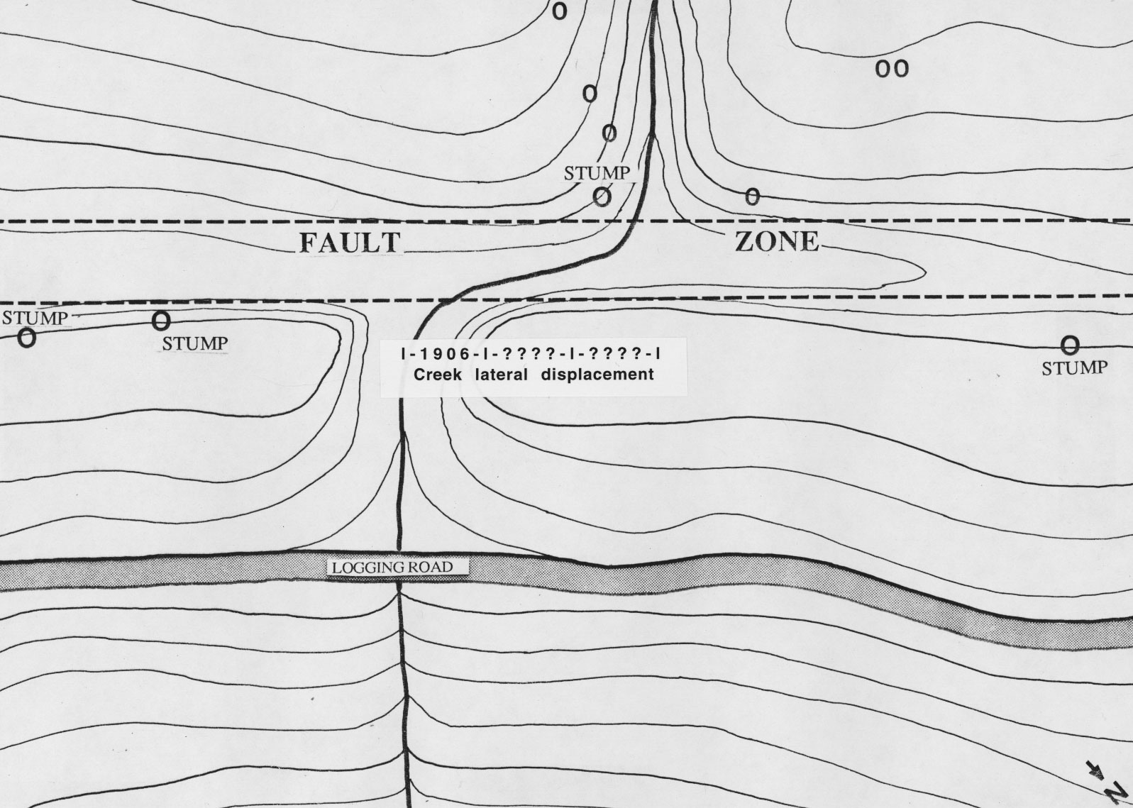
The map above shows the sampling in the redwood forest. The label just below the fault zone indicates the possible displacement distance.
Near Gualala, California
At the northern end of the San Andreas fault, the 1906 earthquake was a
disaster to San Francisco. How often do these earthquakes occur?
We are studying coastal redwood trees along the fault to try and find and
date earlier events. One promising location is at an unamed creek that probably has
been offset by three earthquakes.
The map above shows the sampling in the redwood forest. The label just below the fault zone indicates the possible displacement distance.
The displacement is approximately equal to three times the 1906 movement. We are examining and dating the rings of samples cut from stumps that were logged around the turn of the century to look for evidence of concurrent disturbance in nearby trees.
or go
back to the Earthquakes!!! page.
LAMONT-DOHERTY EARTH OBSERVATORY OF COLUMBIA UNIVERSITY
ROUTE 9W,
PALISADES, NEW YORK 10964
Voice: (845) 365-8517, Fax: (845) 365-8152
Last Updated: January, 2000 (Neil)