Locate the Lakes
 Hey its Adrienne. Just like Beth said, each day when the data comes in I scan through it to see if I can find any subglacial lakes. Today I am have a feeling it might be my lucky day! The Twin Otter just landed and Beth says she has 3 new lines of flight data. I am so excited! Let's check the data files and identify which ones we are interested in!
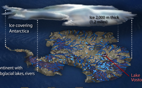
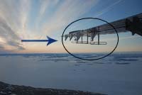
How do we know there is water UNDER the icesheet? We use radar! Flying over the ice we send ice penetrating radar waves right through the ice layers to what lies underneath. The arrow in the picture above is pointing to the radar antenna attached under the plane wing.
Radar waves travel through the ice, measuring both ice thickness and the depth to the rock bed below. Radar goes through ice but it does not travel through liquid water. This means that when the plane flies over a subglacial lake the radar return will be stronger bouncing back with a hard reflection.
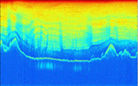
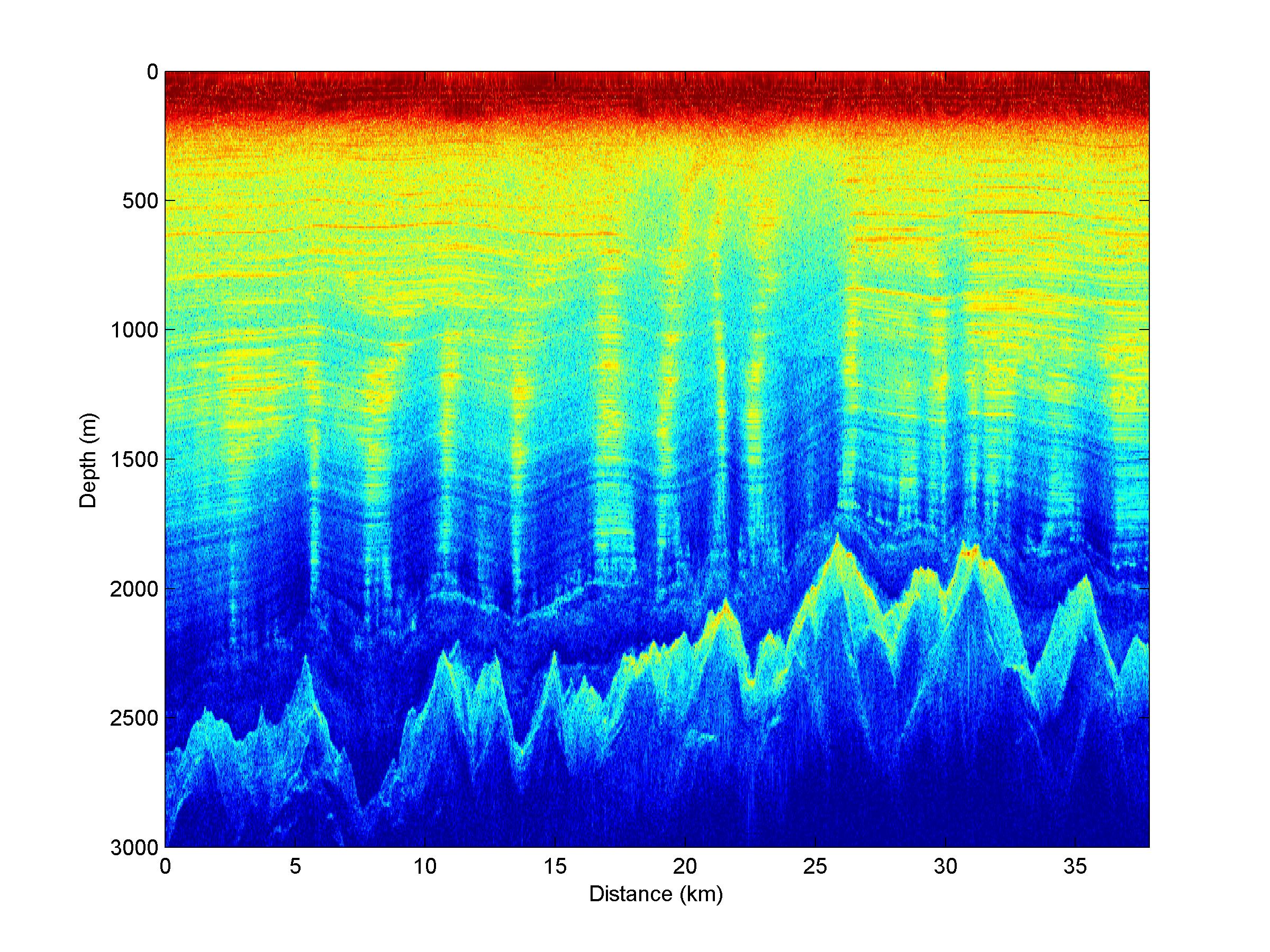
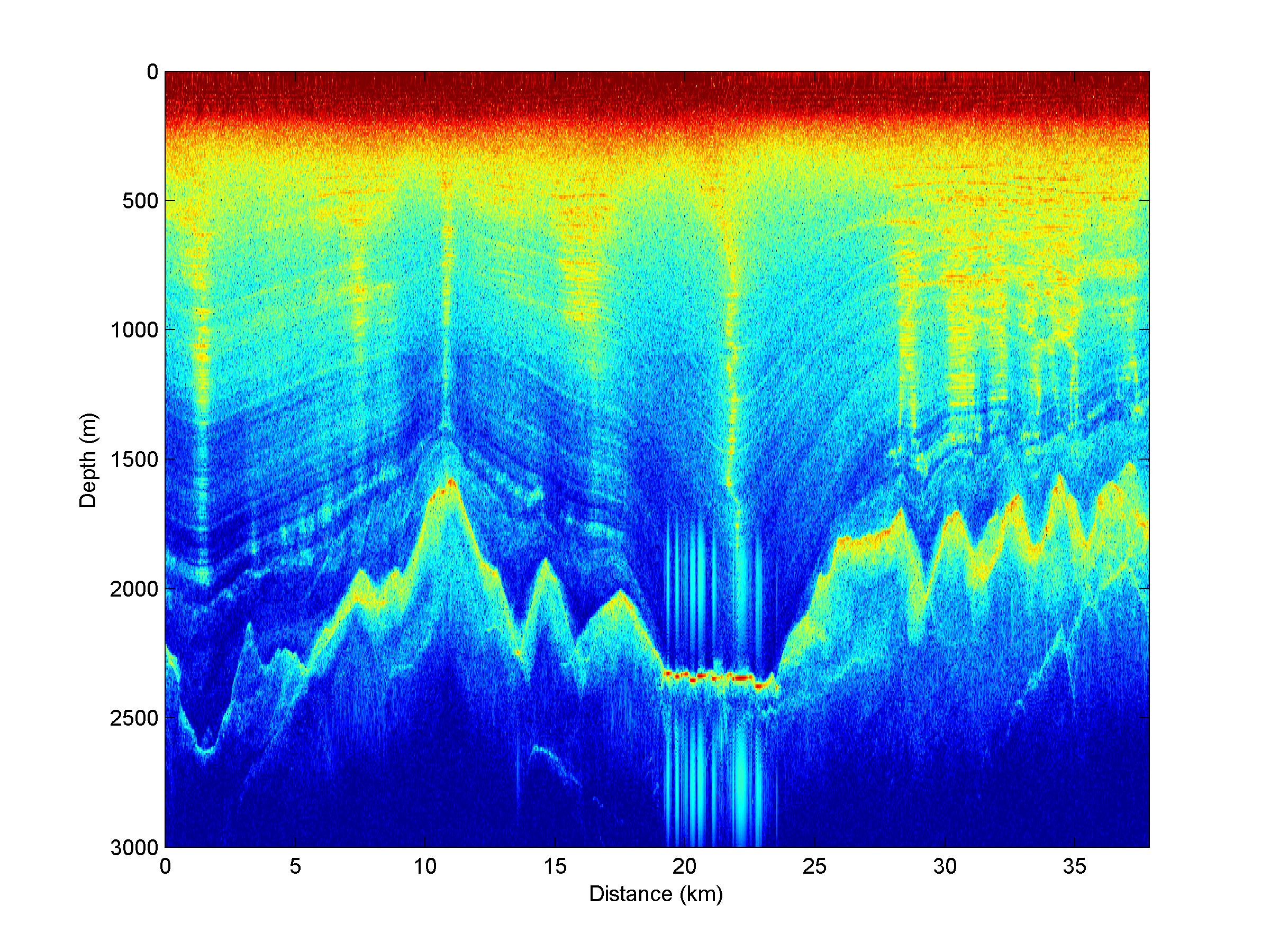
Ready to help? First you should read through the common subglacial lake characteristics listed in 'Try the activity' under 'Find the Lakes in the sample'. Then click on the radar image below to see if you can locate them. Remember we would expect to find the lakes or pockets of water at the lowest area of the valleys.
 |
Subglacial Lake click image to view |
The example above shows you what I am hoping to see in the new data Beth brought back from the field. Although I should tell you this lake is extremely large! Don't expect to find any that large in the lower images! See if you can use your detective skills to help me find which of the new data has subglacial lakes! OK now let's go to "Time for the real deal!"
Student Activity Worksheet - download response sheet word pdf
 |
 |
(Note that all the enlarged images are jpg files. To see them better click on the magnifying tool. Once they are at full size you can use the bottom slider bar to manipulate the image.)