|
|
|---|
Ice Bridge
Greenland Campaign Spring 2012
Greenland Spring Campaign
Lamont-Doherty Earth Observatory
EXTERNAL LINKS
Sea Ice and Fjords
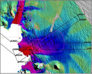
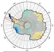
Spring brings the ICE Bridge mission to the Arctic where the science team will collect data on both the sea ice thickness and extent, and the dynamic Greenland glaciers. With the loss of ICESat (NASA Ice, Cloud and land Elevation Satellite) in 2009 the ICE Bridge mission has become even more important as a means of measuring and monitoring the changing polar ice cover. This data is being used to improve both our understanding and our models of global climate change and its associated sea level rise. Home base for these operations will be Thule in northwest Greenland, and further down coast in Kangerlussuaq in Southwest Greenland.
Planning
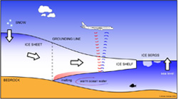
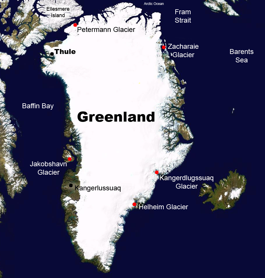 Flight Plans: Spring flights are flown on a P-3B aircraft begin in March. The first few weeks of the campaign are scheduled to fly out of Thule, in Northwestern Greenland focusing on sea ice. In the Arctic, maximum sea ice extent is measured in late spring (March/April) so collecting data on extent and thickness is an important first order of business. The team then moves location to Kangerlussuaq in the southwest of Greenland just below Jakobshavn, the world's fastest moving glacier. In Kangerlussuaq the survey will focus on Greenland's 'outlet glaciers' (fast moving tongues of ice, also called ice streams).
The flights will overfly ICESat ground tracks in areas of interest in order to provide a continuous history of the Arctic changing ice cover as well as flying new lines where outlet glaciers are moving large volumes of ice into the oceans. The data collected on the flights will provide new insight on both how and why Arctic ice cover is changing.