|
 |
|
|---|
ICEPOD
An Integrated Ice Imaging System for LC-130s
Pod Design & Testing
Lamont-Doherty Earth Observatory
EXTERNAL LINKS
IcePod Design & Testing
 |
| Turbulence testing was completed on all the instruments prior to installation in the pod. |
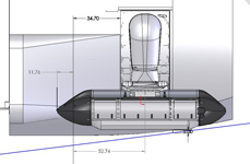
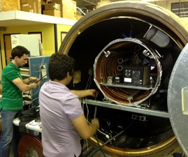
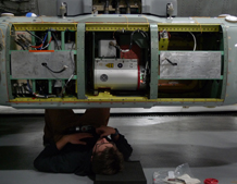
Design: Adding new instrumentation and equipment to any aircraft requires intense scrutiny but on a military plane there are extra rounds of review and sign offs required. The external pod would need to meet full air safety standards, cause limited drag on the aircraft and be easily mounted or removed by the air-crew as needed. The instruments housed in and around the pod would need to be integrated with the aircraft electronics and yet insulated from any interference with the plane and its equipment. An additional challenge was the need to fit the instruments in the small interior cubicles of the pod. Instruments and equipment were compacted and streamlined, and as the pod arm is extended below the aircraft, the instruments would need to be tightly sealed for temperature control and able to pass intense turbulence testing. A full battery of tests were done on each of the instruments as they were designed and modified for use.
 |
| The pod set up in the lab with the Deep Ice Radar blade antenn2a. |
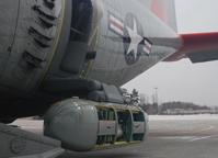
Testing: The icePod was delivered to Lamont the first week of January 2013 for a short three weeks of instrument installation and system checks prior to the first flight testing out of Stratton Air Force Base, Scotia NY. The plan called for local testing to receive clearance for the equipment from the the air force Special Projects Office (S.P.O.) followed by a first round of equipment debugging. The S.P.O. office provides specialists in avionics (electrical systems used in aircrafts) and aerodynamics (air interaction and flow as it meets the aircraft/pod) who measure, and weigh equipment as it is installed in the aircraft, and then monitor the in-air operation of the pod for turbulence, and potential aircraft/equipment interference. Once military clearance is received equipment testing is needed to ensure that all instruments are collecting and recording data. Each instrument is tested and results recorded, including the GPS units, for careful review and analysis so that any issues can be resolved prior to heading to Greenland and Antarctica for final testing.
 |
 |
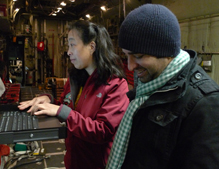 |
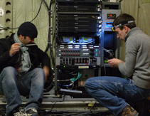
| Checking connections on the rack. | Trouble shooting power in the pod. | Setting up the system for flight testing. |
