|
 |
|
|---|
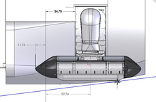
ICEPOD
An Integrated Ice Imaging System for the LC-130s
Background
Lamont-Doherty Earth Observatory
EXTERNAL LINKS
Background
 |
|---|
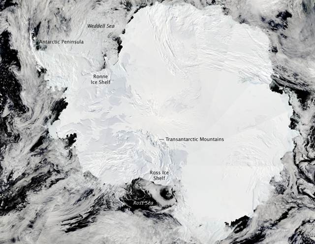
| NASA satellite image of Antarctica. |
Scientists have been studying the Earth's polar regions for over a century making observations and collecting data to better understand these unique areas. Through careful study we have observed the connection between changes and impacts in the polar regions and the rest of the Earth. Regular and ongoing measures of change in the amount of snow accumulation, the volume and thickness of sea ice, and speed of glacier movement need to be collected, monitored and studied.
Beginning in 2003 satellite measurements have been collected as a result of observed changes in the Arctic and Antarctic ice cover. Launched in 2003, NASA's ICESat I collected valuable data on ice sheet mass balance (net gain or loss) until it retired in 2009. April, 2010 the European Space Agency launched CryoSat, a satellite focused on monitoring ice thickness, of both marine and continental ice. Work is underway by NASA to launch a new ice monitoring satellite, ICESat-II, in 2016. Lamont-Doherty Earth Observatory is part of a bridging mission that has been organized to continue to collect specific targeted data on the changes in ice sheets, glaciers and sea ice at this critical time. This project, called IceBridge, will provide valuable information, however each flight is a dedicated science mission, requiring a dedicated plane and crew.
 |
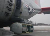
Icepod test flight at Stratton Air Force Base |
The IcePod project offers a more streamlined approach to data collection by piggybacking on the existing flights and crew flying polar support missions. Routine support flights will be the backbone of the science data collection, however targeted science flights can be added to the LC-130 flight schedule. Linking the approximate 200 routine flights to science data collection allows IcePod to collect multiple lines of data over the same polar region not just seasonally, but multiple times during the season.
IcePod offers the science community the opportunity to acquire regular and repeat measurements of coincident ice surface and ice bed data in regions where the ice sheets are undergoing rapid change. This time series data (collected in repeating times), provides criticall information on the process and the timing of how change is occurring.
