|
|
|---|
ICE Bridge
Bridging the Gap: Measuring the Changing Poles
![]()
Home
Lamont-Doherty Earth Observatory
EXTERNAL LINKS
Multi-Institution, Multi-Year, Multi-Parameter |
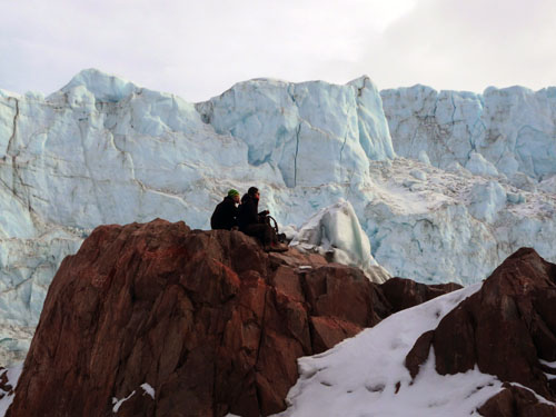
SPRING 2012 FOUND THE TEAM IN GREENLAND!
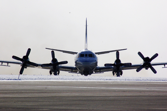
P3 Aircraft taking off from Thule AFB in Greenland as part of the Ice Bridge Spring campaign 2011.
CHECK OUR BLOG SITE
 This season a group of five teachers from the United States, Denmark and Greenland joined the Polar Team in Greenland to experience a few days of field work.
What's Happening In Our Polar Regions?
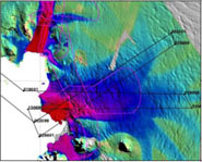
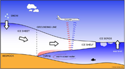
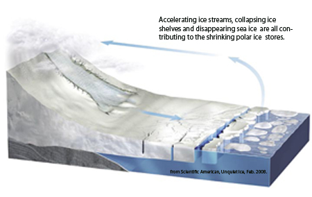 The Ice Sheets at both poles are changing - shrinking at increasing rates - rates that are faster than was ever expected by scientists. Combined with the shrinking of these expansive blankets of continental ice is the disappearance of large expanses of sea ice. These changes will impact all of us through sea level rise and a changing climate globally. But how and when? In order to answer these questions we need to be constantly measuring and monitoring the polar regions for ice thickness, understanding the properties of the rapidly changing ice streams, and looking deeper to see what lies under the tongues of floating ice called ice shelves. These tongues of ice are the terminus of the ice sheet as it streams down from the continent and extends out over ocean water. How much water lies below can have an impact on how quickly the ice will melt, sections of ice will break off, or whole ice sheets start to break apart causing further impact. Working with NASA and other ICE Bridge partners, Lamont will be measuring previously unattainable information. Using high resolution gravity technology, refined and carefully tested in their Antarctic AGAP field season, Lamont scientists will collect data on the space and volume that lies between the ice tongues and the bedrock.
Why is this important?
ICE Bridge is a crucial observational program as it offers the first opportunity to acquire a time series of measurements of coincident ice top and bottom data in regions where the ice sheets are undergoing rapid change.
Time series data provides a sequence of data collected at successive times which will tell us how quickly change is occurring. The majority of the existing ice sheet data collected has been through NASA satellites rotating in space (see background section below), but present measurements do not include information on the ice bed. The ICE Bridge project, with its concurrent data collection about the change in volume and the underlying processes, provides the first chance to understand not just how fast the ice sheets are changing but why.
Some Background
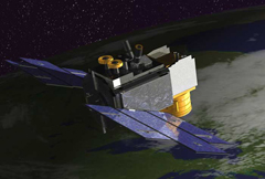 Scientists have been studying the poles for well over a century making observations and collecting data to better understand these unique areas. They have learned that what happens in the polar regions is directly linked to the rest of the Earth; that changes in snow accumulation, magnitude of sea ice, and speed of glacier movement are all items that need to be measured, monitored and understood. Observations that ice sheets in Greenland and Antarctica were shrinking led NASA in early 2003 to launch ICESat I (NASA image), an ice, cloud and land elevation satellite. ICESat I has measured ice sheet mass balance (net gain or loss) collecting valuable data since that time, but stopped functioning in 2009. Work is underway by NASA to develop ICESat-II, but it will not be ready for launch until 2014-15. This created a critical gap in data on the changes in ice sheets, glaciers and sea ice at a time when the polar regions are changing at a speed beyond expectation. In order to bridge this gap NASA has built a team to develop the ICE Bridge Program using DC-8 & P3 in-house aircraft mounted with various pieces of equipment from multiple agencies. Lamont's contribution to this project is the collection of gravity data which can be used to estimate the water depth beneath the ice shelves. This new data will add a new robustness to the ice sheet data being collected.