|
 |
|
|---|
ROSETTA
Antarctic Seasons
![]()
Antarctic Seasons
Decoding the Data
From the Field:
Project Partners:
Institution
Lamont-Doherty Earth Observatory
ROSETTA's has a third field seaons scheduled in Antarctica! The team has completed two seasons November 2015 and 2016 and will return to complete the shelf mapping late October 2017. Follow our progress! Stay tuned!
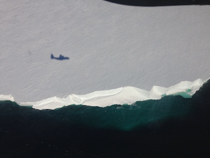
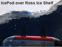
Reflection of the LC130 aircraft flying over the ice shelf by Fabio Tontini
 |
|---|
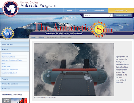
February 2015 article by Michael Lucibella, Editor of the Antarctic Sun. |
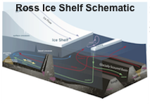
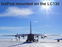
Airborne Surveys - The primary fieldwork focuses on completing a survey, flying back and forth over the iceshelf, building a grid of. We will collect a suite of measurements including ice surface elevation using lidar, ice thickness using radar, the shape and materials of the ocean floor lying under the ice shelf using gravity and magnetics. Season one in 2015 flights were planned at 20 km grid spacing to put together the framework for the 2016 season. The density of the grid will double with the 2016 flights which are designed to be flown at 10 km spacing providig a much more complete picture of the ice shelf itself.
Ocean Measurements - To completement the airborne flights over ice we use Alamo drifters in the ocean. The drifters will collect data on ocean circulation along the front of the ice shelf where the ocean interacts with the ice shelf edge, and where it circulates in and under the ice. Matching this circulation data with the map we are creating for the ocean bed shape beneath the ice will improve our models of how warming water may lead to additional melting of the ice shelf.
 |
Twitter and Instagram for team member Matt Siegfried. |
|---|
Funding to support this project comes from the National Science Foundation and the Moore Foundation.

 This project is funded through NSF & The Moore Foundation |