|
 |
|
|---|
ROSETTA
ROSETTA:The Science Plan
![]()
Science Plan
Decoding the Data
From the Field:
Project Partners:
Polar Geophysics Group of LDEO
Institution
Lamont-Doherty Earth Observatory
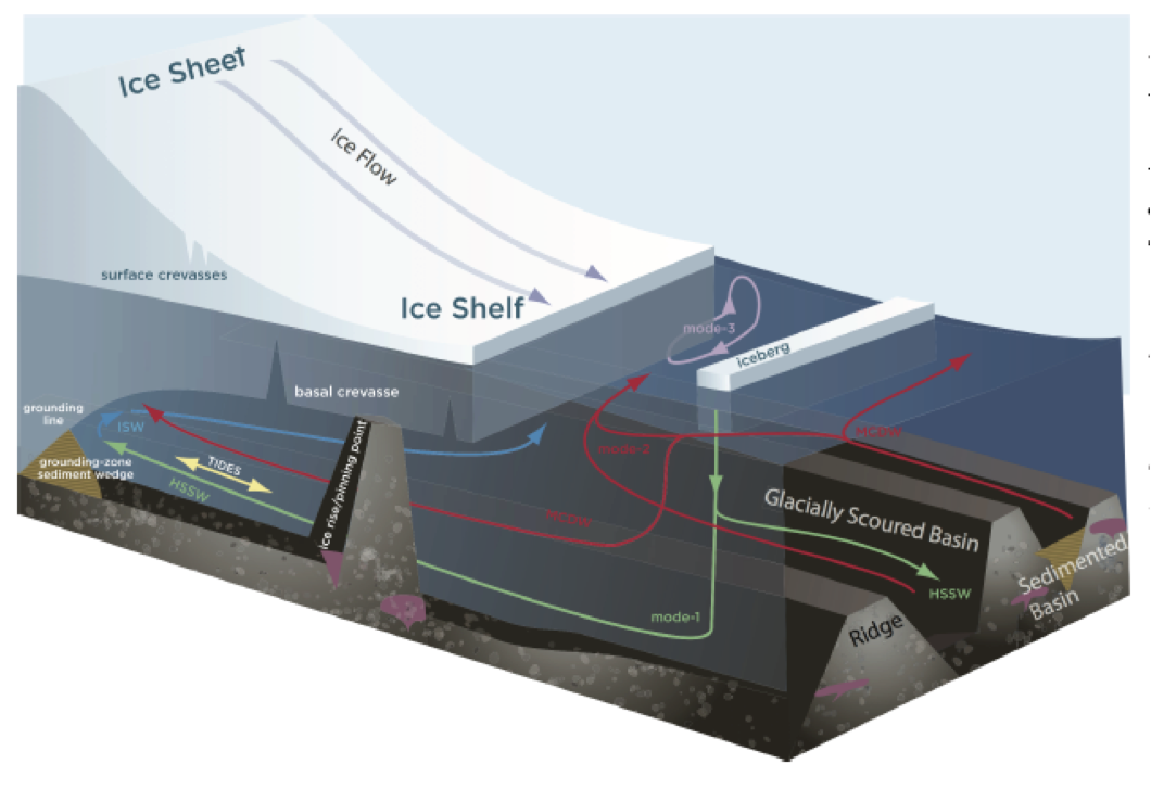
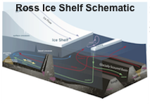
This graphic highlights the different systems being investigated through this project. Starting at the base with the ocean bed we find glacially carved submarine channels
 |
|---|
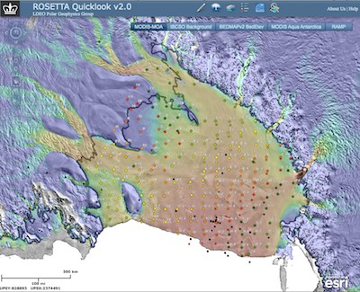
Link to the project interactive GIS tool by clicking on the map image. For more details see GIS Mapping Tool page. The dot son the map represent sampling sites from the historic RIGGS survey of the 1970s. |
ROSSETTA is a large multi-disciplinary and multi-institutional project with several major goals focused on different parts of the full ice shelf system. The project main goals include a focus on:
The Ice - Ice moves into and across the shelf at a range of speeds from 200-1000 m/yr, taking between 500 and 1000 years to travel from where it first goes afloat to where it ends at the calving edge. However evidence collected suggests that the shelf is sensitive to atmospheric and ocean variability, and can change dramatically on short time scales. Understanding this more fully is a project goal.
The Underlying Bed - The bed structure underneath the ice shelf influences ocean circulation below. Through time pre-glacial coastal erosion followed by glacial scouring has carved deepened trenches in the sediment, while the overlying ice has flattened the tops of bedrock ridges. The bed features influence the ocean circulation beneath the ice.
The Ocean - General ocean circulation, tidal currents and the overall mixing in the Ross Sea embayment, including beneath the ice shelf, are sensitive to the geology below as well as changes in the ice shelf extent and ice thickness below the ice surface.
The coupled system of ice, underlying bed and ocean interaction that is the focus of this project requires involvement from an interdisciplinary team of oceanographers, geologists, geophysicists and instrumentation engineers. The project partners include an integrated airborne team from Lamont-Doherty Earth Observatory, glaciologists from Scripps, geologists from Colorado College and oceanogrpahers from ESR. In the field we have gravimeter support from GNS and Dynamic Gravity Systems, geophysical support from U.S.G.S., air support from the New York Air National Guard and LCL productions filming the technology and airborne science.
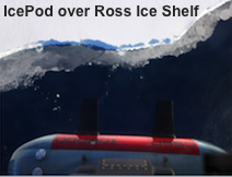
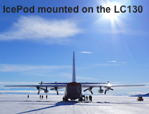
The platform to be used in data collection is the icepod imaging system designed to collect a fully integrated dataset of ice thickness and accumulation (radar), ice surface (lidar and surface imagery). In addition two gravimeters and a magnetometer have been added to the instrument suite to identify the geology and the depth of th Ross embayment below the ice shelf.
 |
Twitter and Instagram for team member Matt Siegfried. |
|---|
Funding to support this project comes from the National Science Foundation and the Moore Foundation.

 This project is funded through NSF & The Moore Foundation |