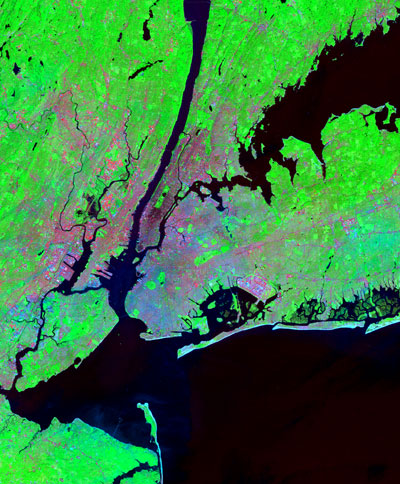
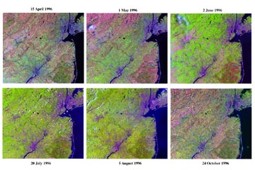
Reflected and emitted Infrared and visible radiance measurements show differences in albedo, surface temperature, vegetation cover.
(Large Images - Plan Accordingly)
(jpeg > 200 K)

Urban vegetation abundance can be estimated to within 10% using Landsat imagery.
See the image above and papers below for details.
If your browser is configured properly it will automatically launch Adobe Acrobat or some similar pdf reader. The Acrobat reader is available to download free HERE.
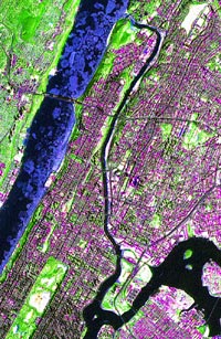
Pan sharpened images combine Landsat 7 ETM+ panchromatic imagery with multispectral imagery.
![]()