 |
maya tolstoy | |||||||||||||||||||||||||
ONGOING RESEARCH
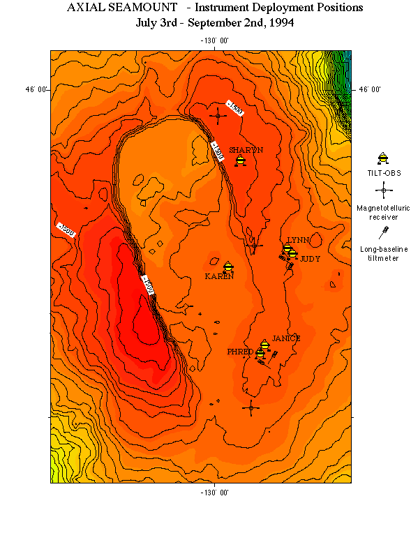
Seismic Activity On Axial Seamount, And It's Correlation With Tilt Data A joint tilt, seismic and magnetotelluric experiment was carried out on Axial Seamount on the Juan de Fuca Ridge in the summer of 1994. A summary of the tiltmeter results, with detailed analysis of the short-baseline tiltmeter results can be found in Tolstoy et al. 1998 (click here). Detailed analysis of the long baseline tiltmeter results can be found in Anderson et al. 1997 (JGR), and the magnetotelluric results are discussed in a paper by Heinson et al. 1996 (GRL). The work discussed here is an analysis of the seismic data collected, including its relation to the short-baseline tilt data. This research is being conducted by M. Tolstoy, F. Vernon, J. Orcutt and F. Wyatt. A figure illustrating the design of the TILT-OBS instrument can be found here.
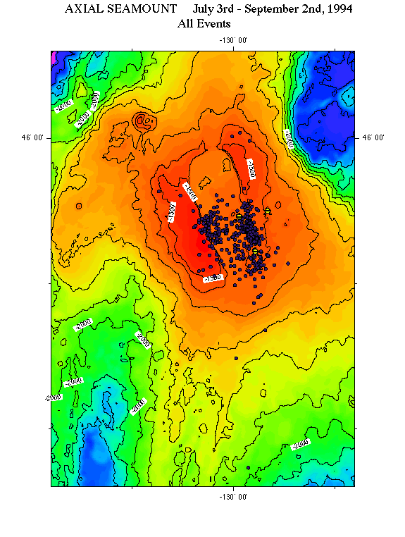
Instrument Locations for Axial Experiment. TILT-OBS Sharyn had a clock error which meant that data could not be succesfully retrieved from this instrument. Janice & Phred and Lynn & Judy were deployed in pairs, located as close to eachother as possible to allow for direct local comparison of tilt data (the experiment's primary objective was a final test deployment for the tiltmeter development project, and therefore the tilt objectives had to take priority over seismic objectives in the experiment design). Therefore for earthquake location purposes, there were essential 3 sites. Nevertheless, 2 months of continuously recorded seismic data at the three locations has provided a wealth of information on seismic activity at Axial Seamount during the deployment period. The figure to the left shows the location of all 402 seismic events located during the 2 month deployment. Note there were many more events occuring during the deployment period, but only those with clear arrivals at all 3 sites could be located. Frequently the strong harmonic tremor, particularly on TILT-OBS Janice, would swamp the record, and also therefore any earthquake activity at the time.
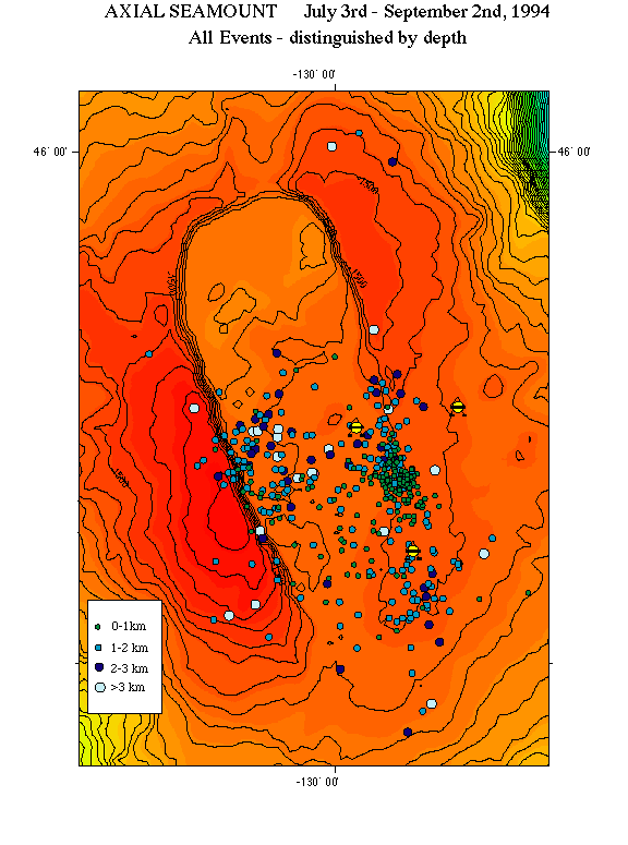
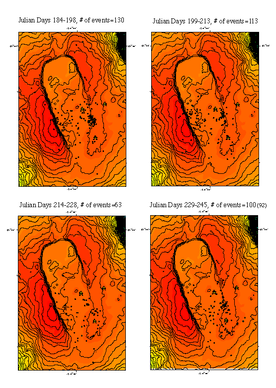
The majority of events occured with, or along the walls of the summit caldera, though this is also clearly related to the instrument locations. Nevertheless, activity to the east of the array (on the flank of the volcano) is virtually non-existent during this time period, whereas there is prolific activity to the west of the array. The next plot (on the right) shows the same 402 events, color and size coded for epicentral depth. The plot below shows the events in ~2 week bins to illustrate the pattern of activity through the 2 month deployment. Note the number of events decays with time, though the activity picks up again toward the end of the deployment. The instruments were deployed around the SOSUS inferred center of activity (C.Fox - personal communication), and indeed, particularly at the start of the deployment, the activity is centered precisely where SOSUS predicted.
|
||||||||||||||||||||||||||