Using Seismic Data to Investigate Landslides from Afar
A new method for detecting big landslides, developed by Lamont geophysicists Göran Ekström and Colin Stark, allows scientists to understand the dynamics of these elusive events almost instantly, without traipsing to remote mountains or scrambling up rugged peaks months, or even years, later. Ekström and Stark have catalogued the 29 largest landslides since 1980 using satellite images and recordings from a global network of seismic instruments. A third of the largest avalanches are documented now for the first time.
“These are very large geophysical events involving many cubic tons of rock and ice,” Ekström said. “In this modern age, it’s surprising that we don’t know more about where and when they occur.”
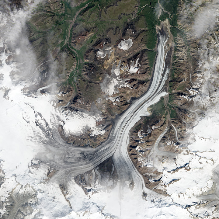
The biggest slide detailed by their efforts was triggered by the 1980 eruption of Mount St. Helens and produced the equivalent of a magnitude 5.6 earthquake. The largest landslides to be uncovered by the study are a wave of seven events in 2010 on Siachen Glacier, in the eastern Karakoram Range of the Himalayas, which produced the equivalent of magnitude 4.6 to 5.1 earthquakes.
The Global Seismographic Network records ground shaking at all frequencies, but seismologists usually pay attention only to the sharp, high-frequency signals emitted by earthquakes and explosions. Landslides, by contrast, produce low-frequency vibrations easily overlooked in the noise.
A decade ago, Ekström and his colleagues began looking at these “slow” signals closely in an effort to locate volcano-generated earthquakes. Their search led to an unexpected discovery: low-frequency signals in Greenland, later dubbed “glacial earthquakes,” produced as calving glaciers dump walls of ice into the sea.
In 2009, Ekström noticed a similar cluster of signals in Taiwan not long after Typhoon Morakot struck. The signals were later traced to landslides set off by the storm’s torrential rains, which wiped out the village of Xiaolin, killing 400 people. “Initially, no other agency had detected or located the four events that we had found, so it seemed very likely that we had detected something special,” Ekström told the Smithsonian at the time.
When faults slip to create an earthquake, they shake the ground with intense, high-frequency waves that are picked up by earthquake monitoring systems worldwide. Landslides also generate waves, but most are of a slower, low-frequency variety.
A large landslide in Alaska’s Wrangell-St. Elias range in July 2013 was detected using the Global Seismographic Network. (NASA Image)
With data from the Xiaolin landslide, Stark and Ekström developed an algorithm to search out the seismic signatures of other big landslides in past and ongoing earthquake recordings. David Petley, a researcher at Durham University in the U.K., praised their new technique. “It opens the way to a true global catalog of rock avalanches that will advance understanding of the dynamics of high mountain areas,” he wrote.
In the future, seismic detection and analysis of landslides could improve scientific understanding of how the rock falls work and perhaps provide warning to vulnerable communities. “In Taiwan, it took 48 hours for the authorities to realize a landslide had happened, valuable time that could have helped people to be rescued,” Ekström said.