The MCS survey was run succesfully in the Imrali I. area and in the Izmit Gulf. This last survey
presented some problems due to ship traffic and to the short distance for manouvering.
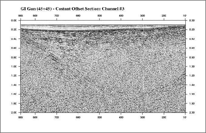
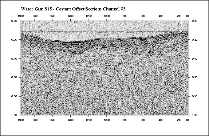
Figs. 34 and 35 show the neartrace of two lines run in Izmit.
Figure 34:
Example of a MCS line run with the 45+45 GI-GUN.
Figure 35:
Example of a MCS line run with the S15.