We collected a very dense grid of SBP and SSS lines, with quality ranging from good to very good, with penetration up to 50-75m.
Figures 45 to 58 of Chapter 4 show the lines run in the surveyed area. Fig.33 shows an example of an acquired CHIRP line.
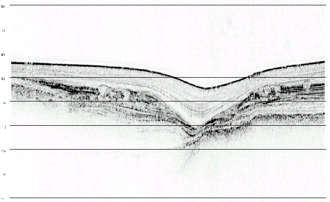
The profiler clearly imaged the post-glacial Holocene (12000Y to present) sediment cover and a complex geometry of buried erosional surfaces. Resolution of bedding at less than 1 meter spacing was achieved for most of the survey, even at depths greater than 1200m in the Cinarcik basin.