Urban Mapping & Monitoring
Global Comparisons High Resolution Thermal Night Lights Hyperspectral Multi-Temporal
In order to map urban extent and monitor changes and growth of urban areas it is necessary to distinguish between urban and non-urban land cover.
This distinction depends on both the aggregate and component physical properties of the urban mosiac as well as those of the surrounding non-urban land cover types. The task is complicated by the fact that some of the components of the urban mosaic (e.g. vegetation, water) are also found in non-urban areas. The task is further complicated by the fact that the spatial scales of the individual components in the urban mosaic (e.g. buildings, streets) is generally comparable to the spatial scale of the Ground Instantaneous Field Of View (GIFOV) of the sensors used to map urban extent (e.g. Landsat, SPOT). The task is still further complicated by the inter-urban and intra-urban diversity of land covers and their physical properties. These three complications largely preclude the use of traditional thematic classification algorithms for urban mapping because these algorithms are generally based on assumptions of spectral homogeneity that are very rarely met in urban environments. For this reason, the research presented here focuses on robust physical characterization of urban reflectance properties and on comparative analyses of diverse urban environments. Spectral Mixture Analysis is investigated as a means to accommodate the variable spatial scale and spectral heterogeneity of the urban mosaic.
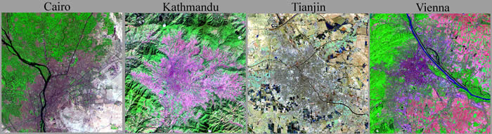
Global Comparisons - Spectral Mixture Analysis of urban reflectance using Landsat 7
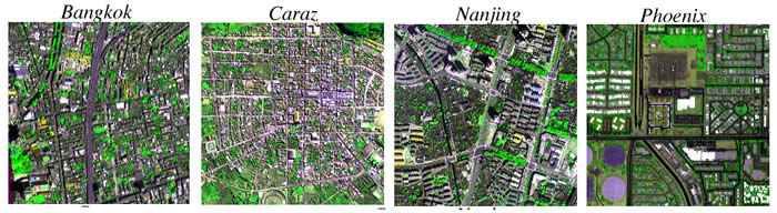
High Resolution - Scale analysis and reflectance characteristics using Ikonos and Quickbird.
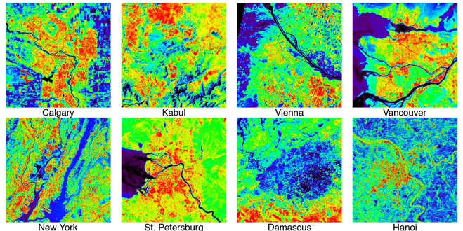
Thermal - Comparative analysis of thermal properties of mixed urban land covers using Landsat 7
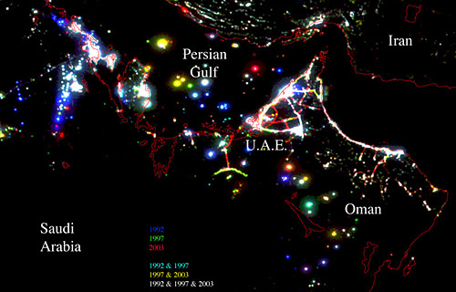
Night Lights - Global spatial analysis and comparison of DMSP night lights with Landsat 7
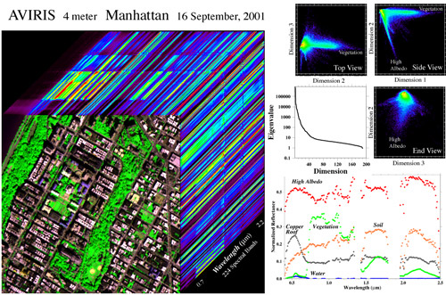
Hyperspectral - Comparison of pervious and impervious surface reflectance properties
Multi-Temporal - Change detection using spectral endmember fractions from Landsat 5.
![]()