Research Interests and Projects
Large parts of the earth surface are shaped by sedimentary processes.
I am fascinated with complex sedimentary features, their morphology,
and understanding the mechanisms that built and modified these
features. Based on my background in geophysics and geology I am using
geophysical techniques to image the morphology, extent, and internal
structure of complex sedimentary features to understand their
evolution as well as the controlling processes. I am exploring new
ways to combine and interpret different data sets using Geographic
Information Systems (GIS) and to integrate geophysical data with
information from sediment cores or biological observations. I am
particularly interested in estuarine processes, sediment transport and
deposition on continental margins, and glacially-influenced sediments.
It is my goal to better understand the evolution of present and past
morphology, what causes and controls deposition, erosion, and, hence
the shape of sedimentary features.
Main Research Topics:
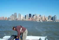
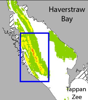
Coastal areas and estuaries are focal points for human development.
Understanding the sediment dynamics of these areas is essential for
successfully managing the resulting economic and environmental needs. We
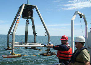
are using a combination of acoustic survey data and sediment samples to
better understand the distribution of deposition, sediment type and
sediment environments as well as the processes and conditions that
controls this distributions. The main focus area is the Hudson River,
but we are also working in the Long Island Sound and other coastal
systems. (
read more)
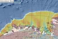
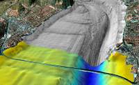
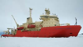
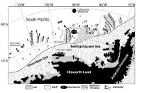
Detailed bathymetry of the Antarctic continental margin can reveal
pathways of sediment and water transported beneath former ice sheets and
allows reconstruction of ice flow. I am involved in various activates to
compile and analyze bathymetric data from all around Antarctica. Much of
the work has been focused on the Amundsen Sea in west Antarctica. In
addition, I am also involved in the International Bathymetric Chart of
the Southern Ocean (
IBCSO).
(read more)
It is often easier to view data in context of
other data and I enjoy creating maps. So I am working with a range of
tools such as GoogleEarth, ArcGIS, GeoMapApp, and Fledermaus to
visualize spatial data in various forms.
(
read more)
Current Projects:
The goal of this project, which is jointly funded by NERC and NSF, is to
examine the sedimentary records both offshore from the glacier and
beneath the ice shelf, together with glacial landforms on the sea bed,
to reconstruct past changes in ocean conditions and the glaciers
response to these changes.
(read more)
The goal of this project, which is funded by a consortium of EPA, CT
DEEP, and NYCDEC, is to generate detailed habitat maps of the bottom of
Long Island Sound.
(read more)
This project will investigate various cross shelf troughs along the East
Antarctic continental margin. Data will be collected on cruise with the
NB Palmer in spring 2015.
This project will investigate changes in sediment deposition in the
upper parts of the Hudson River Estuary as result of the combined
effects of hurricanes Irine and Sandy
(read more)
Previous Projects:
3D-mapping of glacial and glacial-fluvial
deposits in alpine valleys