Area:144,000
km2 Coastline:
580 km Population:
141,340,476
GDP (PPP):
$258.8 billion GDP Per Capita:
$1,900 Population Below Poverty Line:
35.6%
Natural Disaster Risk Hotspots
Click on individual images for larger view
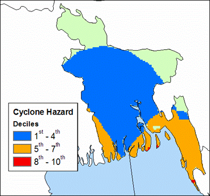
Cyclones
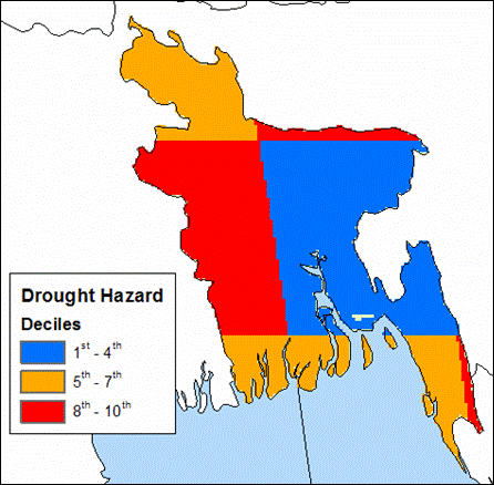
Droughts
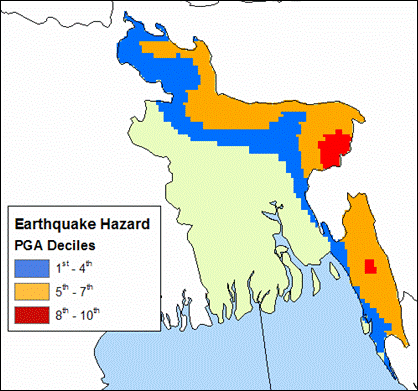
Earthquakes
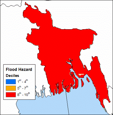
Floods
Landslides
Natural Disaster Risk Hotspots (Weighted by Mortality)
Click on individual images for larger view
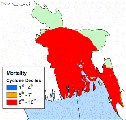
Cyclones
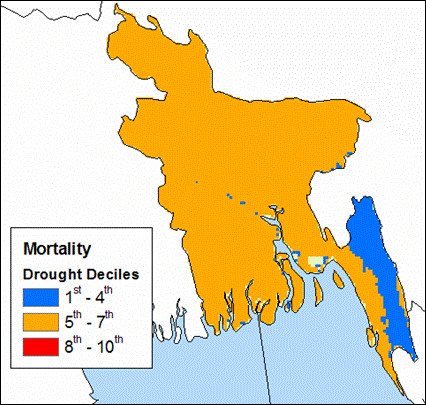
Droughts
Earthquakes
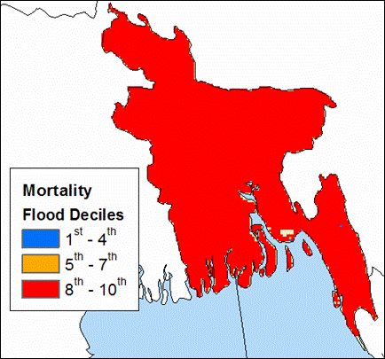
Floods
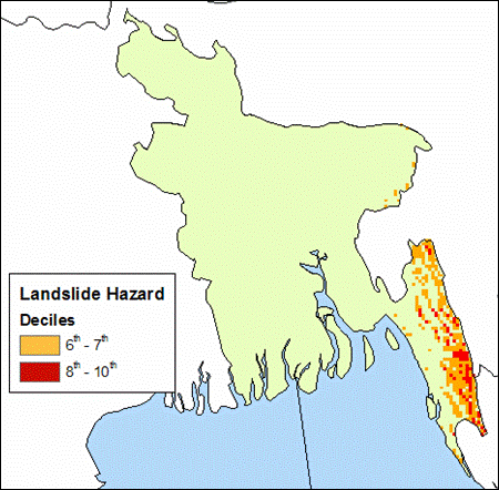
Landslides
EM-DAT Information (1907 - 2004)
Disaster
# of Events
Total Killed
Avg. # Killed
Total Affected
Avg. # Affected
Cyclone
137
614,112
4,483
63,817,281
465,820
Drought
5
18
4
25,002,000
5,000,400
Earthquake
6
34
6
19,125
3,188
Flood
64
50,310
786
369,678,156
5,776,221
Volcano
-
-
-
-
-
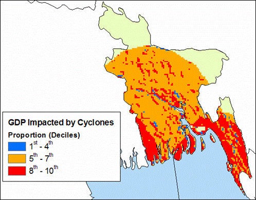
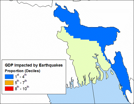
Natural Disaster Risk Hotspots (Weighted by Proportion of
GDP Impacted)
Click on individual images for larger view
Cyclones
Droughts
Earthquakes
Floods
Landslides
Demographic Information:
Population within 1km
of coast
Population within 2km
of coast
Infant Mortality Rate
5,827,219
10,331,836
64.32
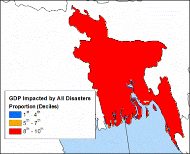
Multi-Hazard Disaster Risk Hotspots (All Hazards combined
and weighted by Mortality and Proportion of GDP Impacted)
Click on individual images for larger view
Mortality
GDP
Multi-Hazard Disaster Risk Hotspots
by Hazard Groups (Top Three Deciles)
Click on individual images for larger view
Observations The hotspots maps indicate that cyclones
and floods pose the greatest risk to Bangladesh on a country
level. Sub nationally, the northern and eastern regions of
the country are susceptible to earthquakes while the southeast
is particularly vulnerable to all five hazards. Lastly, the
combined multi-hazard maps for mortality and GDP show that
Bangladesh ranks in the top 3 deciles of risk when compared
to the rest of the world.