|
Bangladesh
| Burma
| India | Indonesia | Kenya | Malaysia | Maldives | Seychelles | Somalia | Sri Lanka | Tanzania | Thailand
Bhutan Natural Disaster Profile
Basic Facts:
|
Area: 47,000 km2
Coastline:
0 km
Population:
2,185,569
|
GDP (PPP): $2.7 billion
GDP Per Capita:
$1,300
Population Below Poverty Line:
N/A
|
Natural Disaster Risk Hotspots
Click on individual images for larger
view
 |
|
 |
|
 |
|
 |
| |
|
|
|
|
|
|
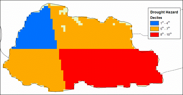
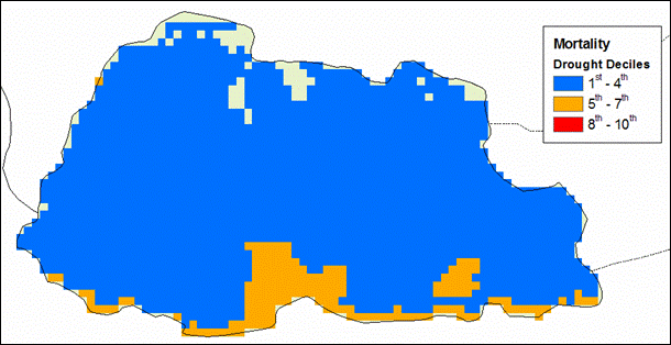
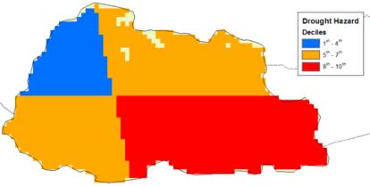
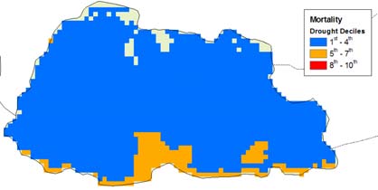
| Droughts |
|
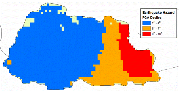
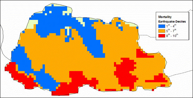
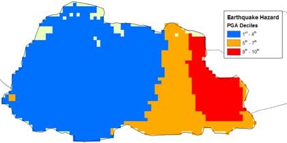
Earthquakes |
|
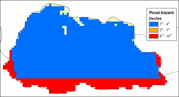
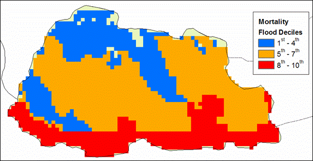
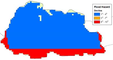
Floods |
|
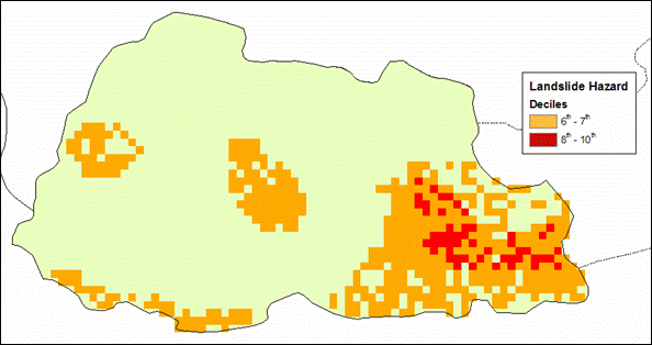
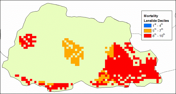
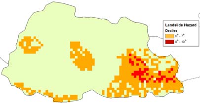
Landslides |
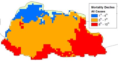
Natural Disaster Risk Hotspots (Weighted
by Mortality)
Click on individual images for larger
view
 |
|
 |
|
 |
|
 |
| |
|
|
|
|
|
|
| Droughts |
|
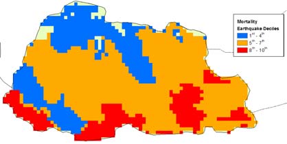
Earthquakes |
|
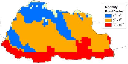
Floods |
|
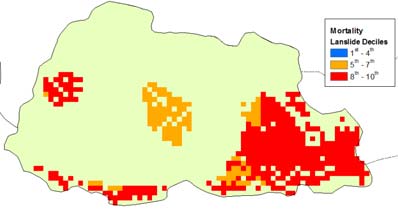
Landslides |
EM-DAT Information (1994 - 2004)
| Disaster |
# of Events |
Total Killed |
Avg. # Killed |
Total Affected |
Avg. # Affected |
| Cyclone |
1 |
17 |
17 |
65,000 |
65,000 |
| Drought |
- |
- |
- |
- |
- |
| Earthquake |
- |
- |
- |
- |
- |
| Flood |
3 |
222 |
74 |
1,600 |
533 |
| Volcano |
- |
- |
- |
- |
- |
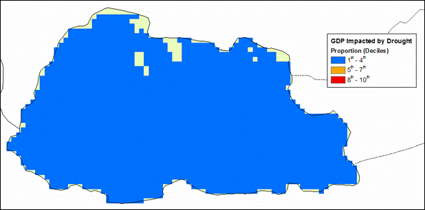
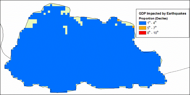
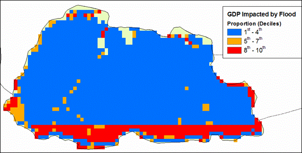
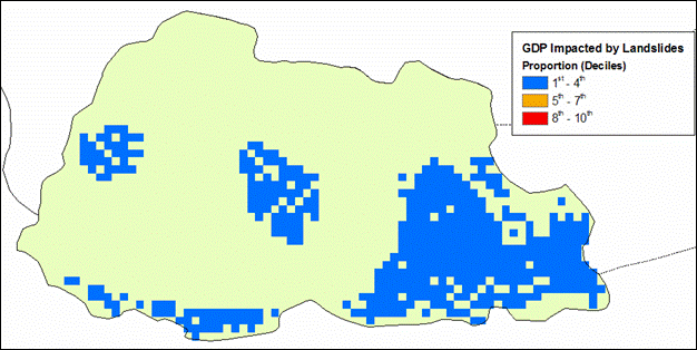
Natural Disaster Risk Hotspots (Weighted
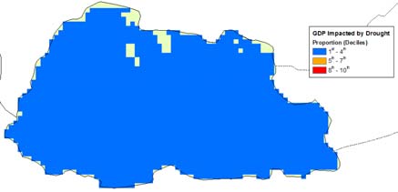
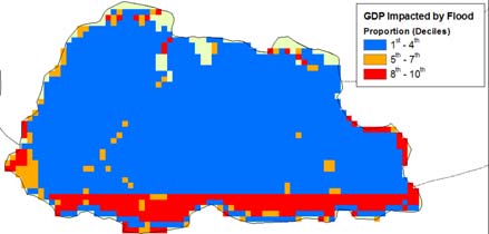
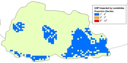
by Proportion of GDP Impacted)
Click on individual images for larger
view
 |
|
 |
|
 |
|
 |
| |
|
|
|
|
|
|
| Droughts |
|
Earthquakes |
|
Floods |
|
Landslides |
Multi-Hazard Disaster Risk Hotspots
(All Hazards combined and weighted by Mortality and Proportion
of GDP Impacted)
Click on individual images for larger
view
 |
|
 |
| |
|
|
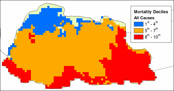
| Mortality |
|
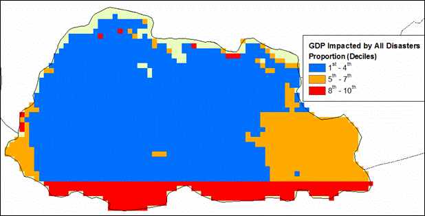
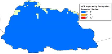
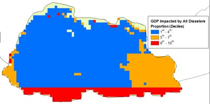
GDP |
Multi-Hazard Disaster Risk Hotspots
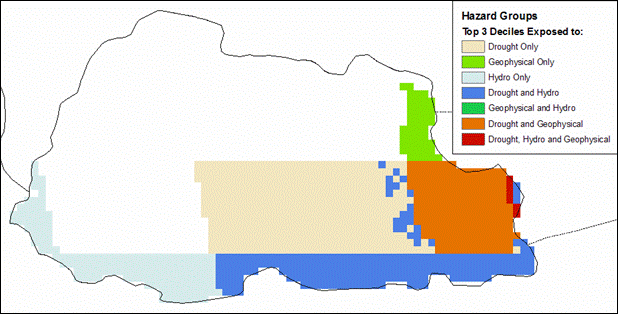
by Hazard Groups (Top Three Deciles)
Click on individual images for larger
view
 |
| |
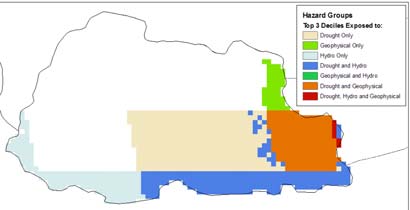
| Group |
Observations
Landslides, earthquakes, and floods all
show high mortality deciles (particularly for the southeast);
however, their respective GDP weighted impacts are confined
to the lower deciles with the exception of floods in the southern
edge of the country. This may suggest that the communities
most vulnerable to these hazards tend to be poorer thus affecting
a smaller proportion of GDP when a disaster occurs.
|